We had to make our way back up to Belfast for the ferry for around dinner time, so we had plenty of time to play with and took a leisurely tour through Navan and stopped in at Kells for lunch and a wander round, and later on we stopped in the city centre of Belfast for dinner and a chance for the kids to spend their pocket money that their grandparents had given them. We took a stroll around Tara, but unlike Newgrange and Knowth, the kids were thoroughly underwhelmed. This place is truly an enthralling series of lumps and small walls, as Mr Seren would put it (though less on the walls, more on the lumps). So while I was enthusing and trying to describe what the place was for, and what it would look like, the kids were kind of, "Is it time to go home yet?"
I have to admit, even as an archaeologist and all round geek for this kind of thing, the site itself is pretty underwhelming, especially when you consider its importance. This is the legendary place where the high kings are said to have been inaugurated, and like many sacred sites it has a long and complex history (and pre-history) of usage. They could do a lot more with it than have a couple of boards you need to read before actually getting to the site itself, so you read stuff without being able to see it or put a physical context to it, and when you get there the various lumps and bumps are simply signposted. There's a pretty abandoned, almost neglected feel to the place (though it's not). You can get a tour guide to take you round, and there's a heritage centre too, but there could be so much more here. That, of course, takes money and investment, and until it gets a fancy international status like Newgrange has, that's not really likely to happen.
Anyway. Before I go into things, how about an overview of the site? This is an antiquarian sketch, thanks to Wikipedia, that gives you a bird's eye view of what you're about to see:

Each name comes from the work of the nineteenth century antiquarian, George Petrie, who took a great interest in the place and studied the Dindshenchas (placename lore) that details the various sites at Tara as they were known in the medieval period. Based on the descriptions in the Dindshenchas, he worked out the names of each mound or rath, and the scheme has stuck ever since. Really, though, the whole thing has little basis in fact.
One thing to remember is that although the site's pretty large and complex, these aren't places that were all in use at the same time. The earliest features here are Neolithic, then bits were added in the Bronze Age and beyond as other bits fell out of use or were altered, and so on. The site was abandoned in the early medieval period, so all in all what we see today is a view of several thousand years of usage.
Once you arrive at the place there's a short walk up to it from the road, past the information boards, along a path, and past this guy:
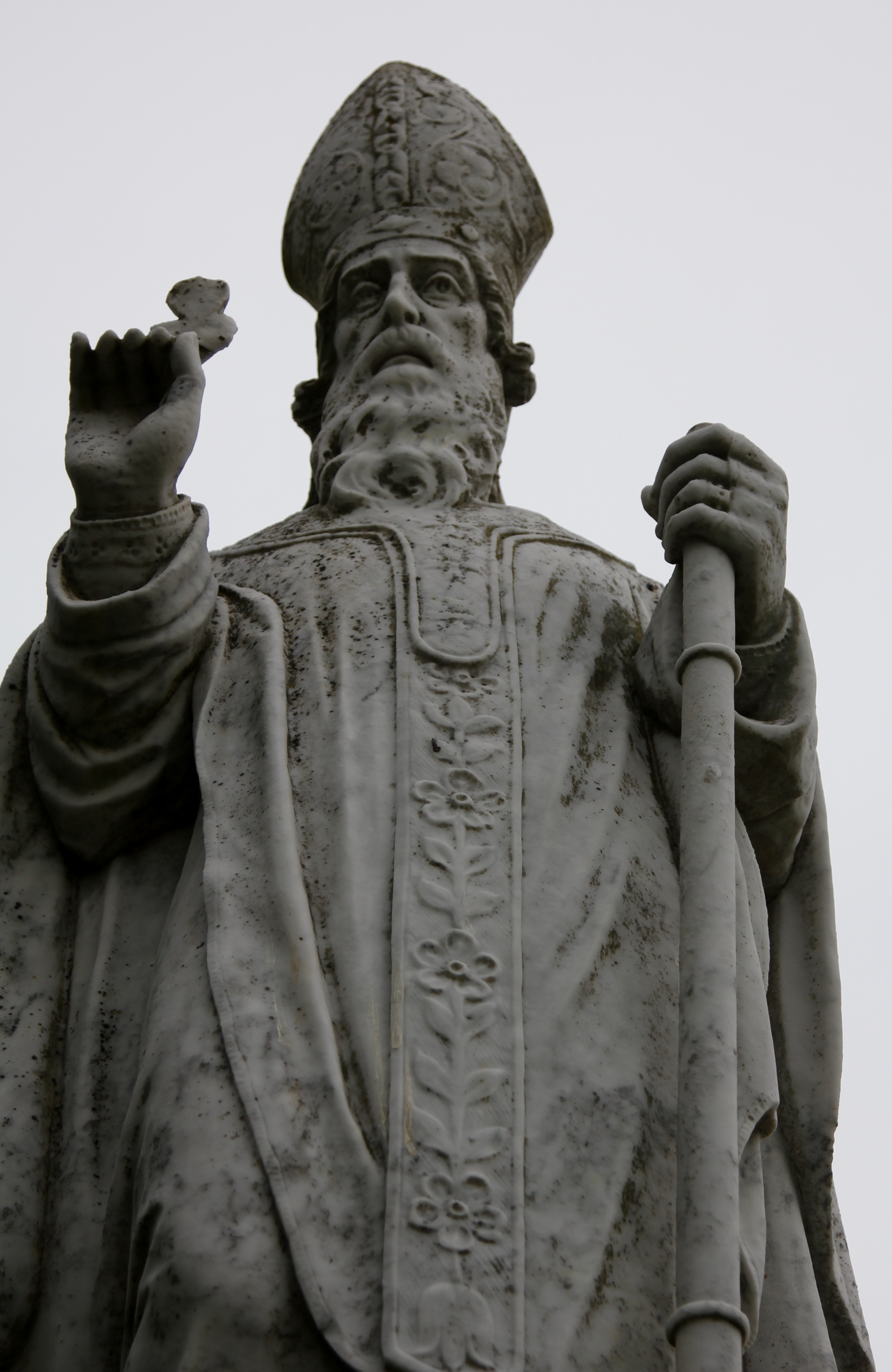
Dear old St Patrick, with his shamrock. There's a church (now the visitor centre) nearby, too, which is walled off, and all of this is an obvious attempt at recontextualising the place, from pagan to Christian. The church isn't ancient - references to it can be found from about the twelfth century on - but it indicates how important the site was even after it fell out of use.
We went along the wall, up a path through a field and along a row of massive hawthorns, and arrived at this view:
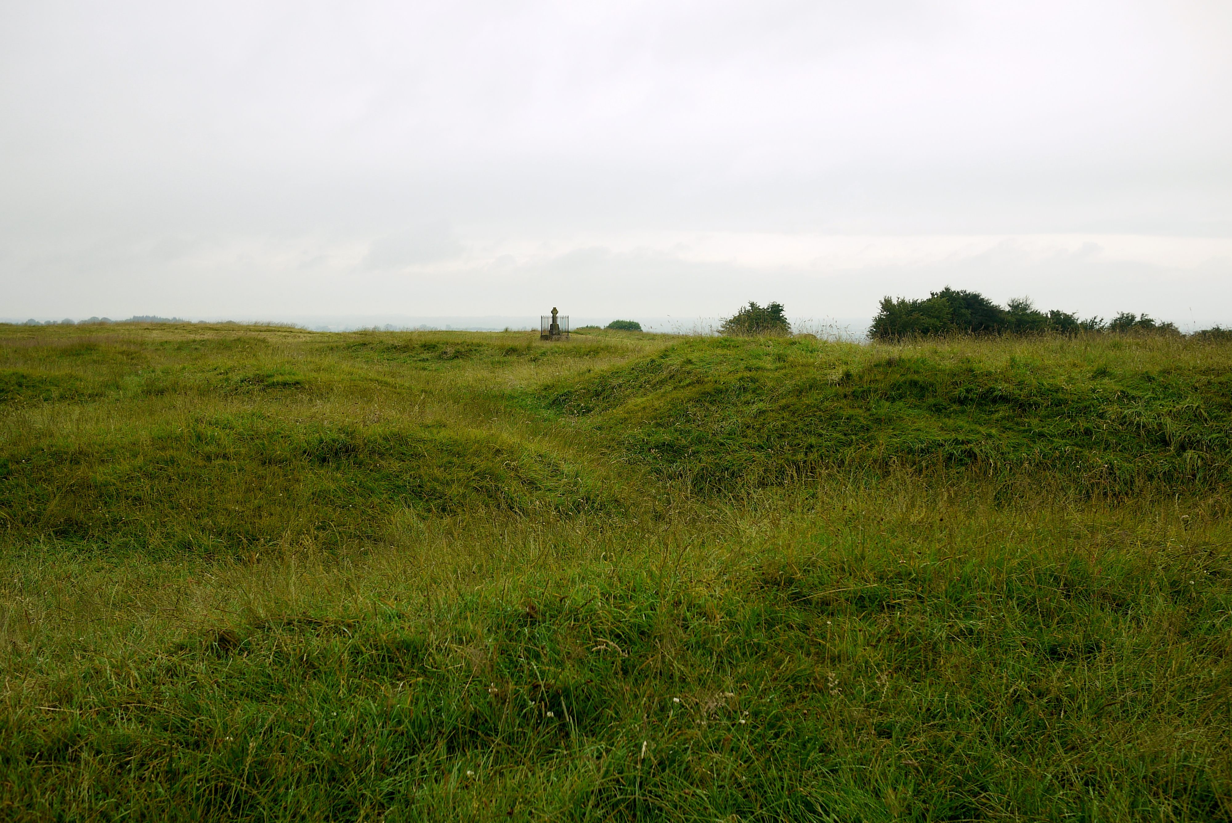
Lumpy bits! (Actual archaeologist's jargon, that is, honest).
This is the bit marked Rath-na-Seanadh, otherwise known as the Rath of the Synods, on the overview by Wakeman, above. It gets its name from the fact that Saints Patrick, Rúadán, and Adamnán are said to have held synods here, but it was probably originally a burial mound which was then turned into a ring fort, possibly surrounded by three concentric banks and ditches with internal timber enclosures as well. Of all the so called raths at the site, this one is the only one that was probably inhabited on a permanent basis for any length of time. Over all, the Hill of Tara seems to have been primarily ceremonial in nature; people didn't live here all year round, but there were probably places to stay on a temporary basis when the site was being used ceremonially.
The graveyard attached to the nearby church has encroached on part of it, and it's also been disturbed by a group of "British Israelites" who tried digging bits of it in a search for the Ark of the Covenant between 1899 and 1902. No, really! The reason they dug here isn't as random as it might seem; their reasoning is that the daughters of Zedekiah hid the Ark of the Covenant, and one of the daughters was called Tea. Tara - in Irish, Teamhair - is named after a woman called Tea, according to the Dindshenchas. Obviously they decided that this Tea was the same as the daughter of Zedekiah.
Looking at it all close too, it doesn't make much sense these days, it's really just a jumble of lumps and bumps. As you stand facing it, though, you can make out a linear earthwork, or what was once thought to have been Teach-Miodhchuarta, if you turn your head to your right:
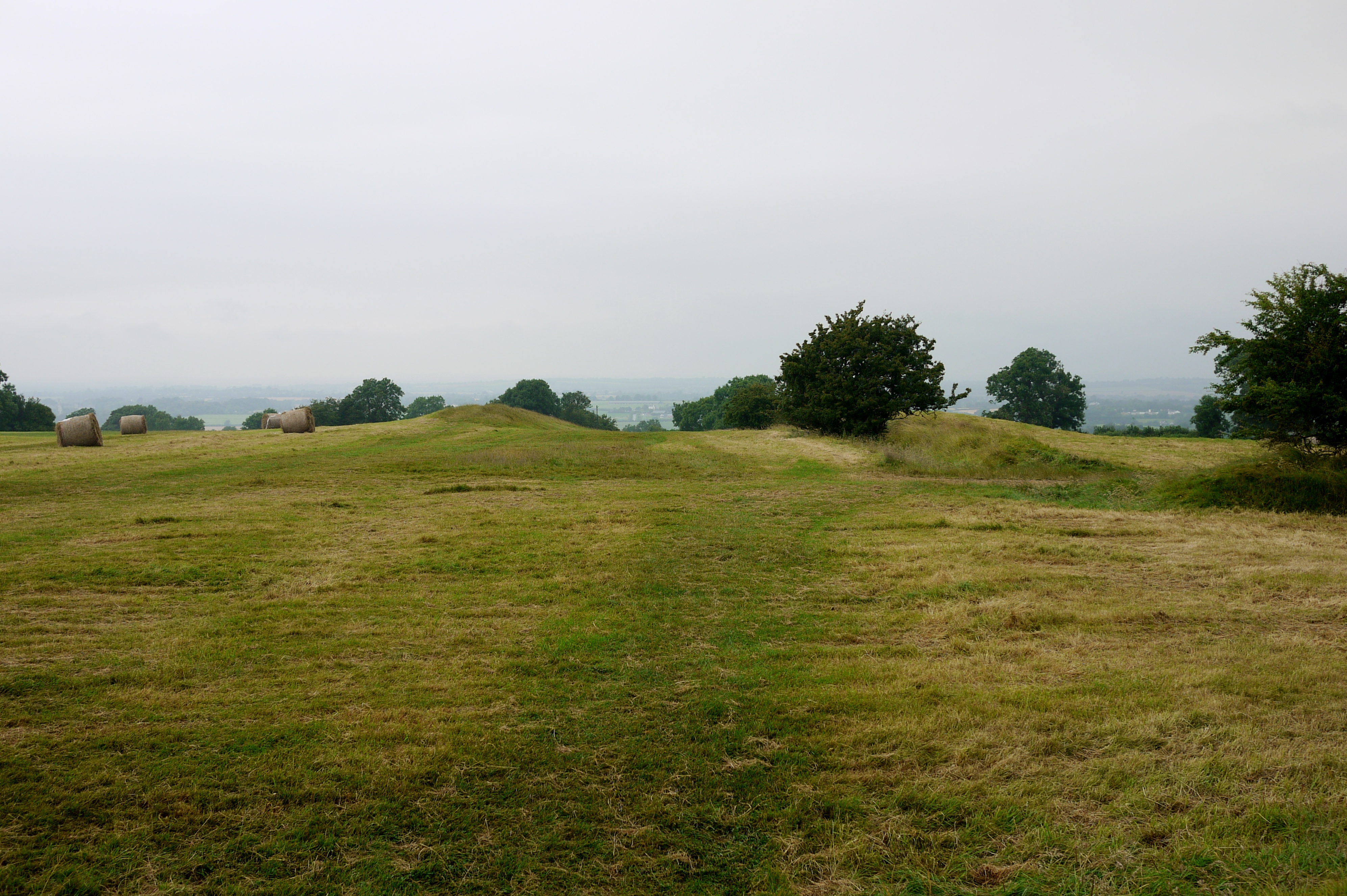
One bank is right near the hay bales on the left, the other is along by that big bush to the right, and it runs down the hill.
Teach-Miodhchuarta is said to have been the feasting hall, where the high king would have entertained the lesser kings and their retinues from all over Ireland. Medieval literature goes to great lengths to describe the layout and seating plan of the building, along with the different cuts of meat that each person was entitled to, all of which depended on each individual's status and profession, where they came from, and so on. The seating arrangements might also depend on who was high king - which túath they came from.
The basic idea might actually have some basis in historical fact, but the place at the Hill of Tara that bears its name was never a feasting hall. It's more likely to have been a cursus, or ceremonial, processional avenue, indicating that it was probably the main way people approached the Hill of Tara complex. Getting all theoretical, this is a way of controlling the way people approach and interact with the space around them. The banks at either side of the cursus blocks your view to either side as you approach, and keeps you looking ahead to where you're going. As you walk along your horizons are closed in, but once you come out, your view expands to take in the site itself, and the area surrounding it (which is expansive - very typical for this kind of site), so it gives the place more of an impact. Entering the site is as much of a revelation as the ritual you're experiencing is, then, so in a way it helps to focus and emphasise that aspect.
The cursus is oriented north-south, and you come from the north, heading south to the hill. It also forces you to approach the site and then enter it so you'd be most likely to process around the place in a sunwise direction. All of this is very much in keeping with the broader points of what we can glean of Iron Age ritual practice, so it's useful to look at all this and how it relates to us today - what we're doing as Gaelic Polytheists.
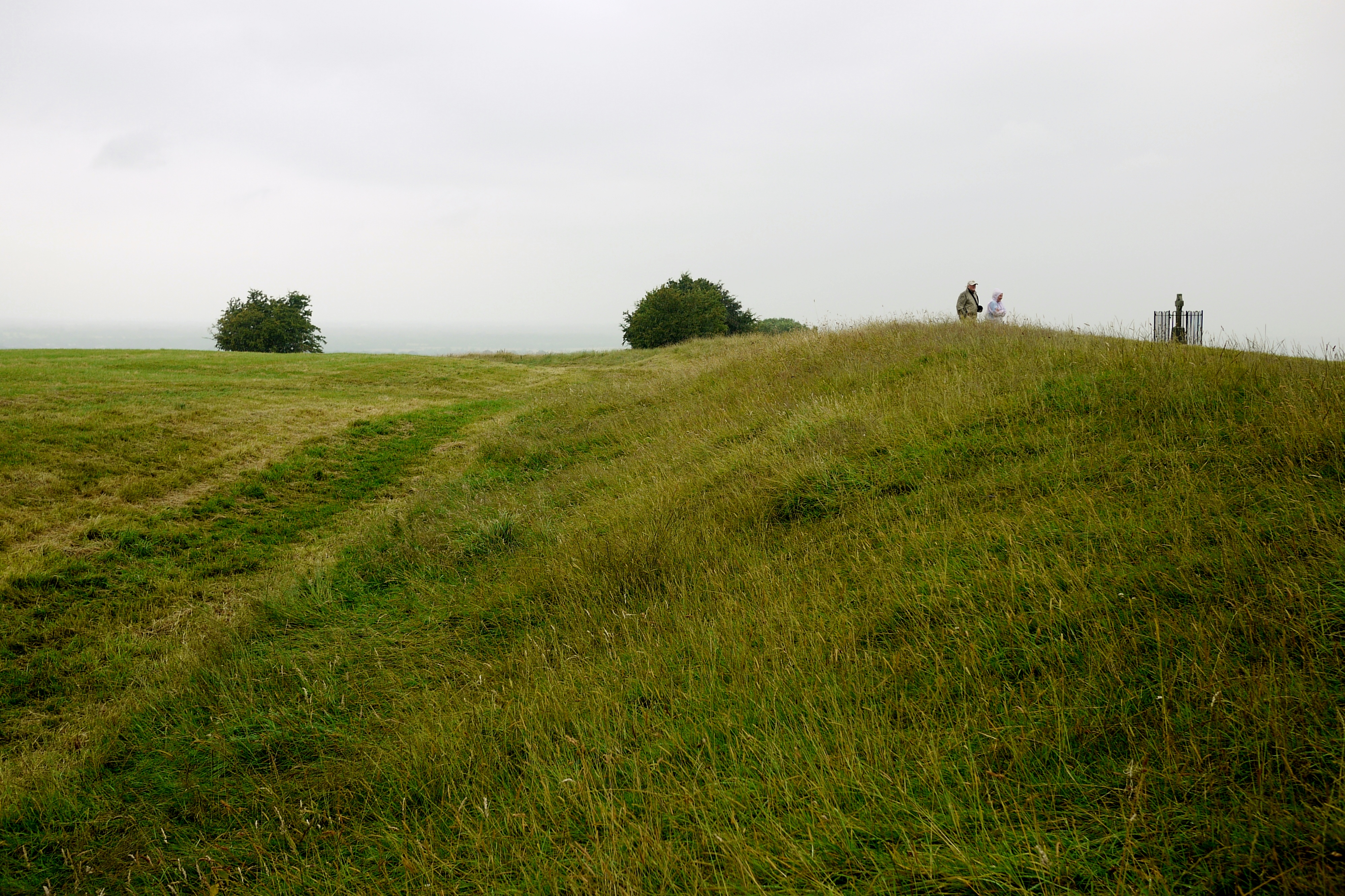
The raths that are marked on the overview near the cursus are actually ring barrows, not forts, and they're not very obvious from where we were stood as we entered:
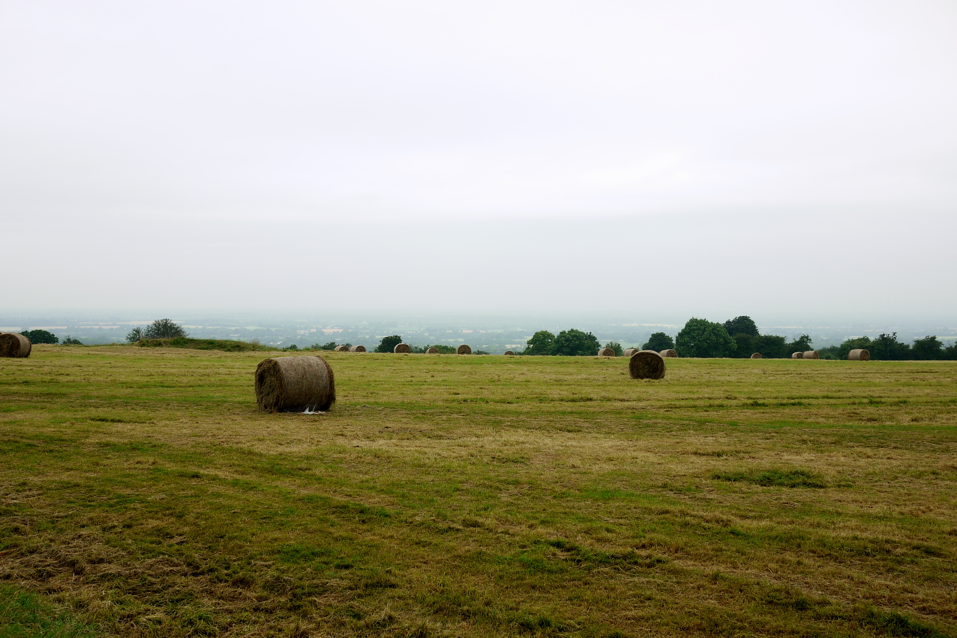
They've pretty much been ploughed flat now, anyway. This picture would probably have a breathtaking view if the weather had been better, but I think the mist and gloom offers its own moody atmosphere, in its own way.
Turning left, from the Rath of the Synods, you head towards the main area of the site. You go over a bank and ditch, which is called Raith na Ríogh, or the Rath of the Kings (or just the Royal Enclosure), and this is the bank that goes around the Mound of Hostages and a couple of raths, one of which is home to the Lia Fáil:
That's the view along the bank just as you've entered the enclosure. Originally it would have been a bit higher, and the silted-up ditch situated right before it was dug right down to the bedrock, three metres down. Way more impressive than it looks now.
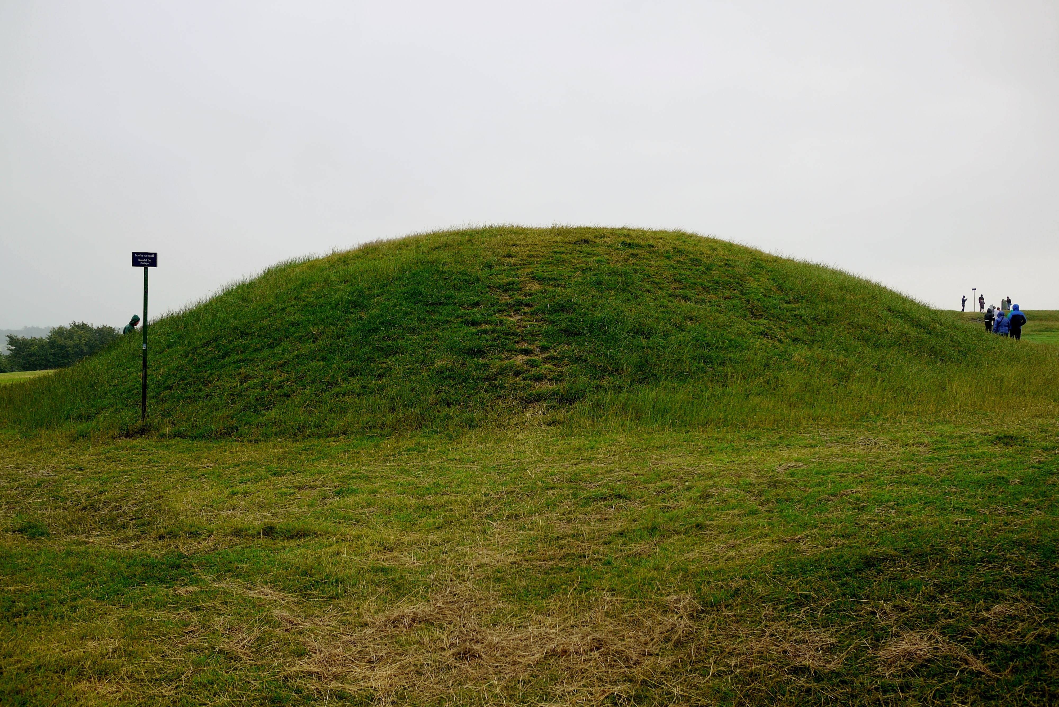
If you turn left to face into the enclosure, you're confronted with a good view of Dumha na nGiall, the Mound of Hostages, which is actually a Neolithic burial mound:
Most people headed past it to the right, straight over to the Lia Fáil, but if you go round to the left you come to the entrance, which has been recently restored. Looking through the bars you can see a small chamber inside:

The megalithic art gives the feeling that it's maybe describing the surrounding landscape? Or a landscape. Whatever it is, it seems very similar to the megalithic art right inside the chamber at Loughcrew...
The Mound of Hostages was used to inter the cremated remains of various individuals for well over a thousand years, up until about 1700 B.C.E., and the entrance is apparently oriented to the sunrise around Samhain and Imbolc. Into the Bronze Age, it seems the small chamber began to get too crowded to continue using it, so the remains were buried into the mound itself. Around 40 Bronze Age burial urns, containing cremated remains, have been recovered from the mound, along with one skeletal burial from the same period.
In the Dindshenchas, the mound gets its name from the idea that King Cormac's hostages were buried there. These aren't the kind of hostages in the prisoners of war sense, but more like high status people from other túatha who were sent to live with the high king as a kind of political insurance between the two nations - behave, or the hostage gets it, mmm'kay? The age of the mound dates well before Cormac, so the story's pretty spurious, but the point about their being high status does hold some weight. Going by the bits of jewellery and other objects, these people do seem to have been high status individuals, and some of the beads that have been recovered from the site can only come from a few places. The most likely location is Wessex, in the south-east of England, around the Stonehenge area, but whether it was just the beads, or the person wearing them too, that came that far, we don't know. They were certainly unusual items, and that generally means the jewellery indicates prestige and status.
Moving past the Mound of Hostages you come to the Forradh and Teach Cormaic, the two raths within the enclosure. Teach Cormaic is named after one of the most famous high kings of Ireland, Cormac mac Airt (the same Cormac who allegedly buried hostages in the mound), who's thought to have reigned sometime between the 2nd to 4th centuries C.E. He appears in tales like Cath Maige Mucrama, but again, his association with the place doesn't hold much weight in factual terms. His reputation as a good king means he's more likely to be associated with a site that symbolises the very concept than a bad king.
Both of the raths inside the enclosure are surrounded by two banks and ditches each, which meet each other. The Forradh (Royal Seat) is the one that's currently home to the Lia Fáil, the Stone of Destiny, which is supposed to have been involved in the inauguration rites of the high kings, and which isn't phallic at all, honest. It's said that when the rightful high king of Ireland puts his right foot on the stone, it should roar or scream its approval, which would be heard throughout the whole country:
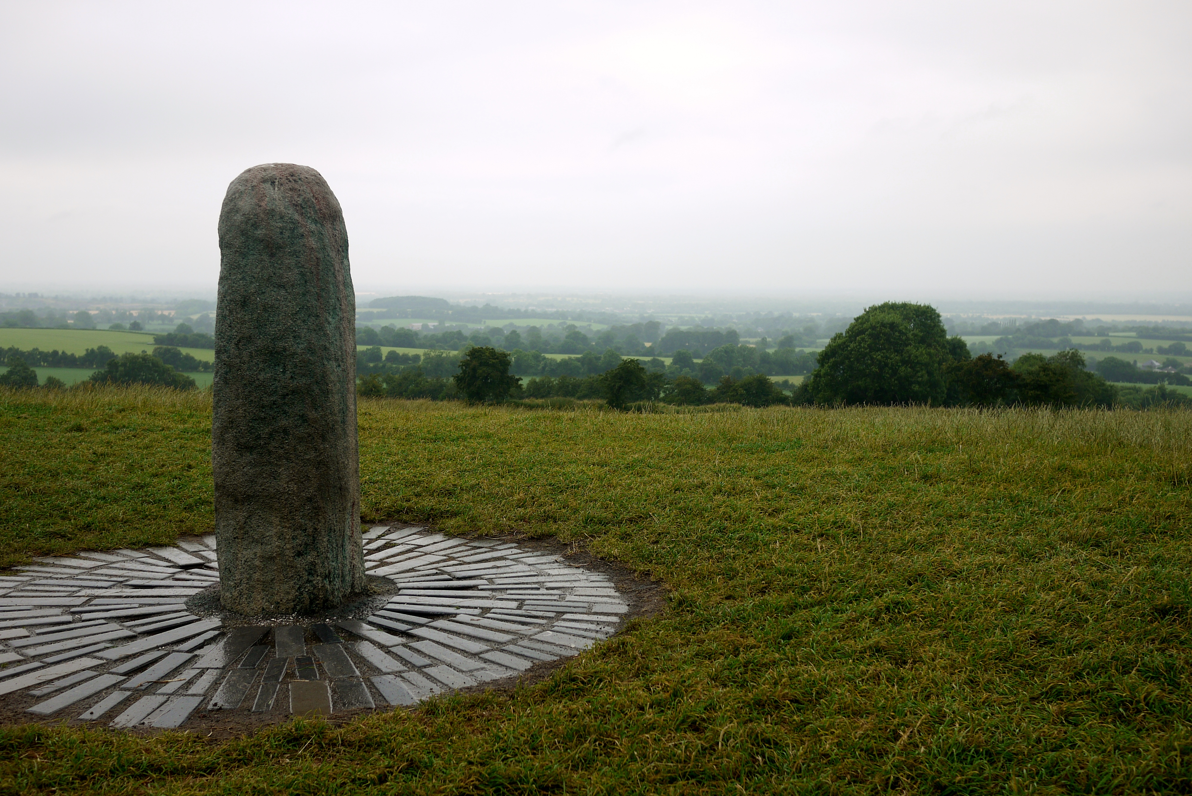
Evidently neither Tom nor Rosie are the rightful rulers. We checked. Whether that has something to do with the fact that the stone's not in its original position, I couldn't say... Either way, it's thought to have originally been situated on top of the Mound of Hostages, before it was moved to the Forradh in "the modern period" (according to Barry Raftery, though he doesn't specify exactly when).
The current state of stone is one of the things that just goes to show how much investment in this place is needed:

You can still see traces of the red and green paint that was thrown all over it back in May, and the dents where vandals attempted to chip pieces off two years ago. As far as I know there haven't been any prosecutions over either cases.
Heading back to the car, Mr Seren took a walk through the graveyard and with the kids, as I hung back to wait for a group to get out of the way so I could take some photos of the Mound of Hostages. As he walked through, he stumbled across this:
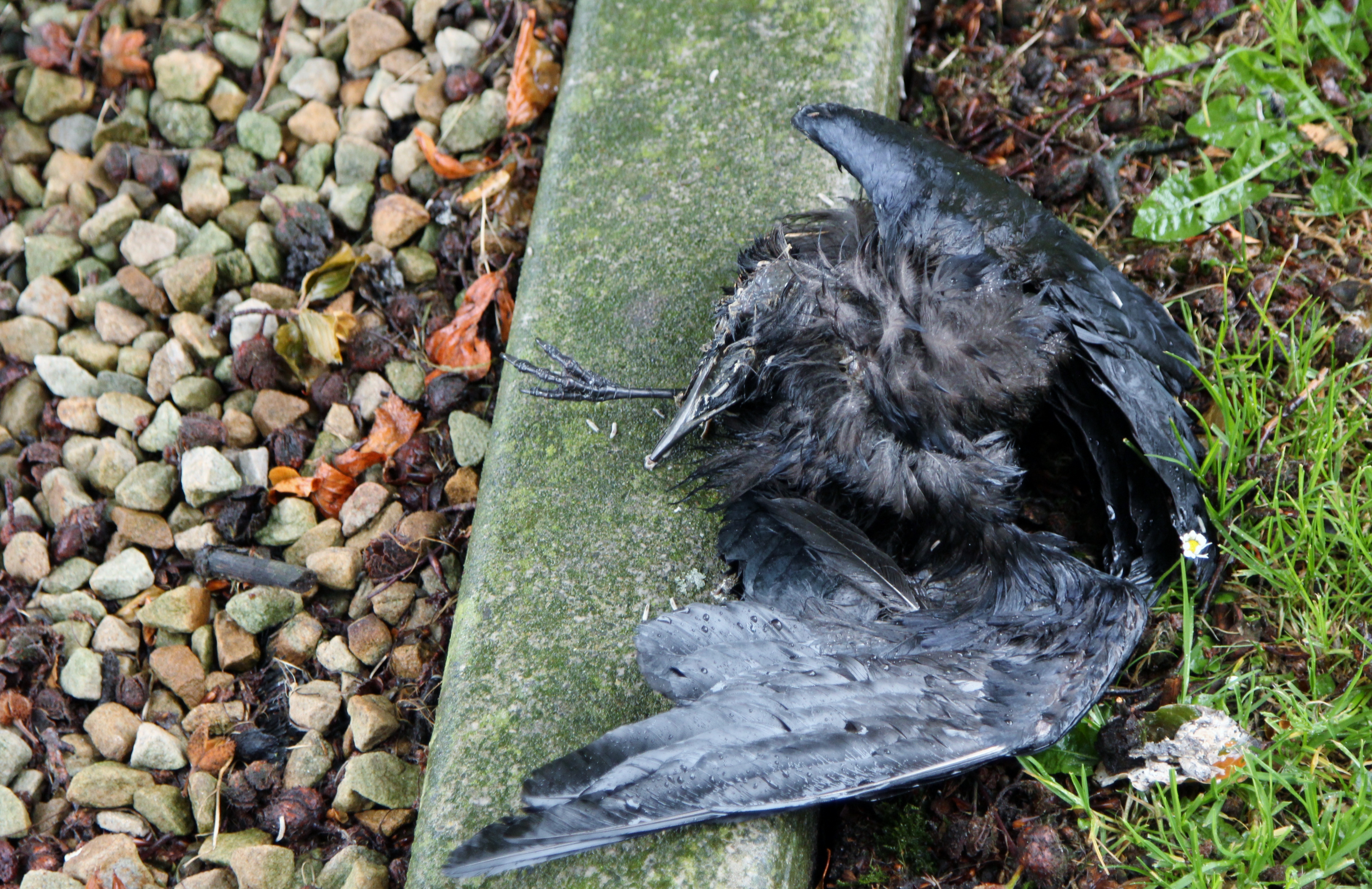
Which he said seems to have been deliberately placed there. The grave it was on was relatively recent, so whether it had some kind of significance to the person buried there, or whether it was just moved "out of the way" or something, I'm not sure. I'm pretty sure it's a dead rook, so if the choice of deposition is deliberate, whoever's buried there probably wasn't so popular in life... Even Mr Seren was weirded out by it, and that takes a fair bit of doing.
But so endeth our trip! I hope you've enjoyed these posts (as much as I enjoyed going to all these places and taking the photos). I might have some more thoughts to chew on at some point, but for now that's it.