Monday 28 July 2014

Tairis is back

Hurrah!

The site's back up, but there's still a bit of technical fiddling that needs doing, which is to say I have no real grasp of what that is so I'm just nodding and smiling at Mr Seren and doing as I'm told right now. Hopefully the fiddling won't result in further downtime, but if it does it should only be brief. I think. Touch wood...

Once all the technical bits are done there might be some formatting that needs fixing, and links updating, etc, but that shouldn't take too long to sort out (famous last words, right?). Thanks for your patience, though. While you're bearing with me, here's the internet equivalent of hold music:


Edit: Except...it's down again. Guh.

Sunday 27 July 2014

New videos...

Since we released a bunch of videos earlier this month, which took us up to Midsummer in the festival year, Kathryn and I have been working hard on the next batch so we can get them out in time for Lùnastal.

Picking up where we left off, then, now have a new video for Lùnastal (Lúnasa):


And then tying in with that we have a video on the Prophecy of the Morrígan - Badb's Prayer for Peace:


Following on from that, we get to Là Fhèill Mìcheil, which roughly coincides with the autumnal equinox:


As with the other videos, Lúnasa and Là Fhèill Mìcheil are intended to be a short introduction to the festivals, giving an overview of the historical roots, lore, and practices associated with them. Là Fhèill Mìcheil is primarily celebrated in Scotland, but we also touch on the broader points of the significance of the solstices and equinoxes in Gaelic belief, as well as the customs that are observed in some parts of Ireland at this time. For more information on the festival, you can always take a look at the article I've done on Tairis (link to the archive, because the site is still down - hopefully not for much longer...).

The music we've chosen for the Lúnasa are two different versions of a traditional reaping song, called Buain a' Choirce (lyrics and translation are at the link). The first version, by Martyn Bennett, is a fusion of a more modern musical arrangement, with the song itself sung in the traditional style by his mother, the Scottish folklorist Margaret Bennett, and the rhythm track uses a sample of an old 1920s threshing machine. The second version, by Síleas, is a more traditional rendition over all.

The second video, on Badb's prayer for peace, is intended to tie in with Lúnasa, as well as Samhain, as we explain in the announcement we released over on Gaol Naofa. Lúnasa is the one time of the year where peace is an essential condition of the celebrations and gatherings that are held in honour of Taillte, as Lugh instituted the festival in her memory. We've chosen this particular prayer, as sung by the Morrígan from Cath Maige Tuired, because the tale has many elements that fit in with what Lúnasa is all about, as well as Samhain. Historically, a failure to uphold the peace at Lúnasa would have risked being thrown out of your túath, which was a serious consequence in a time when your legal rights were heavily tied in with your status and standing amongst your people. Without a túath you effectively had no legal rights, making you fair game, basically. Given the seriousness of all this, it's something that we, as Gaelic Polytheists, should think about too.

More videos are still to come, at some point. All that remains to say is another big thank you to everyone who's helped us produce the videos, from those of you who've helped us find music we can use, given us feedback and general support, and those of you who've very generously given us permission to use your photos. In particular, I'd like to thank Ali Isaac for allowing us to use her photo of Taillte's assembly site in our Lúnasa video. Mòran taing!

Friday 25 July 2014

Hill of Tara

Our original plan was to visit the Hill of Tara on our first day, along with Newgrange, but the whole Newgrange thing took up pretty much the whole afternoon. Seeing as we'd been up since 4am, it seemed prudent to reschedule Tara to another day, so we had to abandon our original Friday plans for Loughcrew and/or Uisneach so we could fit Tara in. Seeing as we'd already done Newgrange, another tomb complex like Loughcrew could wait.

We had to make our way back up to Belfast for the ferry for around dinner time, so we had plenty of time to play with and took a leisurely tour through Navan and stopped in at Kells for lunch and a wander round, and later on we stopped in the city centre of Belfast for dinner and a chance for the kids to spend their pocket money that their grandparents had given them. We took a stroll around Tara, but unlike Newgrange and Knowth, the kids were thoroughly underwhelmed. This place is truly an enthralling series of lumps and small walls, as Mr Seren would put it (though less on the walls, more on the lumps). So while I was enthusing and trying to describe what the place was for, and what it would look like, the kids were kind of, "Is it time to go home yet?" 

I have to admit, even as an archaeologist and all round geek for this kind of thing, the site itself is pretty underwhelming, especially when you consider its importance. This is the legendary place where the high kings are said to have been inaugurated, and like many sacred sites it has a long and complex history (and pre-history) of usage. They could do a lot more with it than have a couple of boards you need to read before actually getting to the site itself, so you read stuff without being able to see it or put a physical context to it, and when you get there the various lumps and bumps are simply signposted. There's a pretty abandoned, almost neglected feel to the place (though it's not). You can get a tour guide to take you round, and there's a heritage centre too, but there could be so much more here. That, of course, takes money and investment, and until it gets a fancy international status like Newgrange has, that's not really likely to happen. 

Anyway. Before I go into things, how about an overview of the site? This is an antiquarian sketch, thanks to Wikipedia, that gives you a bird's eye view of what you're about to see:


Each name comes from the work of the nineteenth century antiquarian, George Petrie, who took a great interest in the place and studied the Dindshenchas (placename lore) that details the various sites at Tara as they were known in the medieval period. Based on the descriptions in the Dindshenchas, he worked out the names of each mound or rath, and the scheme has stuck ever since. Really, though, the whole thing has little basis in fact. 

One thing to remember is that although the site's pretty large and complex, these aren't places that were all in use at the same time. The earliest features here are Neolithic, then bits were added in the Bronze Age and beyond as other bits fell out of use or were altered, and so on. The site was abandoned in the early medieval period, so all in all what we see today is a view of several thousand years of usage.

Once you arrive at the place there's a short walk up to it from the road, past the information boards, along a path, and past this guy:


Dear old St Patrick, with his shamrock. There's a church (now the visitor centre) nearby, too, which is walled off, and all of this is an obvious attempt at recontextualising the place, from pagan to Christian. The church isn't ancient - references to it can be found from about the twelfth century on - but it indicates how important the site was even after it fell out of use.

We went along the wall, up a path through a field and along a row of massive hawthorns, and arrived at this view:


Lumpy bits! (Actual archaeologist's jargon, that is, honest).

This is the bit marked Rath-na-Seanadh, otherwise known as the Rath of the Synods, on the overview by Wakeman, above. It gets its name from the fact that Saints Patrick, Rúadán, and Adamnán are said to have held synods here, but it was probably originally a burial mound which was then turned into a ring fort, possibly surrounded by three concentric banks and ditches with internal timber enclosures as well. Of all the so called raths at the site, this one is the only one that was probably inhabited on a permanent basis for any length of time. Over all, the Hill of Tara seems to have been primarily ceremonial in nature; people didn't live here all year round, but there were probably places to stay on a temporary basis when the site was being used ceremonially. 

The graveyard attached to the nearby church has encroached on part of it, and it's also been disturbed by a group of "British Israelites" who tried digging bits of it in a search for the Ark of the Covenant between 1899 and 1902. No, really! The reason they dug here isn't as random as it might seem; their reasoning is that the daughters of Zedekiah hid the Ark of the Covenant, and one of the daughters was called Tea. Tara - in Irish, Teamhair - is named after a woman called Tea, according to the Dindshenchas. Obviously they decided that this Tea was the same as the daughter of Zedekiah.

Looking at it all close too, it doesn't make much sense these days, it's really just a jumble of lumps and bumps.  As you stand facing it, though, you can make out a linear earthwork, or what was once thought to have been Teach-Miodhchuarta, if you turn your head to your right:


One bank is right near the hay bales on the left, the other is along by that big bush to the right, and it runs down the hill. 

Teach-Miodhchuarta is said to have been the feasting hall, where the high king would have entertained the lesser kings and their retinues from all over Ireland. Medieval literature goes to great lengths to describe the layout and seating plan of the building, along with the different cuts of meat that each person was entitled to, all of which depended on each individual's status and profession, where they came from, and so on. The seating arrangements might also depend on who was high king - which túath they came from.

The basic idea might actually have some basis in historical fact, but the place at the Hill of Tara that bears its name was never a feasting hall. It's more likely to have been a cursus, or ceremonial, processional avenue, indicating that it was probably the main way people approached the Hill of Tara complex. Getting all theoretical, this is a way of controlling the way people approach and interact with the space around them. The banks at either side of the cursus blocks your view to either side as you approach, and keeps you looking ahead to where you're going. As you walk along your horizons are closed in, but once you come out, your view expands to take in the site itself, and the area surrounding it (which is expansive - very typical for this kind of site), so it gives the place more of an impact. Entering the site is as much of a revelation as the ritual you're experiencing is, then, so in a way it helps to focus and emphasise that aspect.

The cursus is oriented north-south, and you come from the north, heading south to the hill. It also forces you to approach the site and then enter it so you'd be most likely to process around the place in a sunwise direction. All of this is very much in keeping with the broader points of what we can glean of Iron Age ritual practice, so it's useful to look at all this and how it relates to us today - what we're doing as Gaelic Polytheists.

The raths that are marked on the overview near the cursus are actually ring barrows, not forts, and they're not very obvious from where we were stood as we entered:


They've pretty much been ploughed flat now, anyway. This picture would probably have a breathtaking view if the weather had been better, but I think the mist and gloom offers its own moody atmosphere, in its own way.

Turning left, from the Rath of the Synods, you head towards the main area of the site. You go over a bank and ditch, which is called Raith na Ríogh, or the Rath of the Kings (or just the Royal Enclosure), and this is the bank that goes around the Mound of Hostages and a couple of raths, one of which is home to the Lia Fáil:


That's the view along the bank just as you've entered the enclosure. Originally it would have been a bit higher, and the silted-up ditch situated right before it was dug right down to the bedrock, three metres down. Way more impressive than it looks now. 

If you turn left to face into the enclosure, you're confronted with a good view of Dumha na nGiall, the Mound of Hostages, which is actually a Neolithic burial mound:


Most people headed past it to the right, straight over to the Lia Fáil, but if you go round to the left you come to the entrance, which has been recently restored. Looking through the bars you can see a small chamber inside:


The megalithic art gives the feeling that it's maybe describing the surrounding landscape? Or a landscape. Whatever it is, it seems very similar to the megalithic art right inside the chamber at Loughcrew...

The Mound of Hostages was used to inter the cremated remains of various individuals for well over a thousand years, up until about 1700 B.C.E., and the entrance is apparently oriented to the sunrise around Samhain and Imbolc. Into the Bronze Age, it seems the small chamber began to get too crowded to continue using it, so the remains were buried into the mound itself. Around 40 Bronze Age burial urns, containing cremated remains, have been recovered from the mound, along with one skeletal burial from the same period.

In the Dindshenchas, the mound gets its name from the idea that King Cormac's hostages were buried there. These aren't the kind of hostages in the prisoners of war sense, but more like high status people from other túatha who were sent to live with the high king as a kind of political insurance between the two nations - behave, or the hostage gets it, mmm'kay? The age of the mound dates well before Cormac, so the story's pretty spurious, but the point about their being high status does hold some weight.  Going by the bits of jewellery and other objects, these people do seem to have been high status individuals, and some of the beads that have been recovered from the site can only come from a few places. The most likely location is Wessex, in the south-east of England, around the Stonehenge area, but whether it was just the beads, or the person wearing them too, that came that far, we don't know. They were certainly unusual items, and that generally means the jewellery indicates prestige and status.

Moving past the Mound of Hostages you come to the Forradh and Teach Cormaic, the two raths within the enclosure. Teach Cormaic is named after one of the most famous high kings of Ireland, Cormac mac Airt (the same Cormac who allegedly buried hostages in the mound), who's thought to have reigned sometime between the 2nd to 4th centuries C.E. He appears in tales like Cath Maige Mucrama, but again, his association with the place doesn't hold much weight in factual terms. His reputation as a good king means he's more likely to be associated with a site that symbolises the very concept than a bad king.

Both of the raths inside the enclosure are surrounded by two banks and ditches each, which meet each other. The Forradh (Royal Seat) is the one that's currently home to the Lia Fáil, the Stone of Destiny, which is supposed to have been involved in the inauguration rites of the high kings, and which isn't phallic at all, honest. It's said that when the rightful high king of Ireland puts his right foot on the stone, it should roar or scream its approval, which would be heard throughout the whole country:


Evidently neither Tom nor Rosie are the rightful rulers. We checked. Whether that has something to do with the fact that the stone's not in its original position, I couldn't say... Either way, it's thought to have originally been situated on top of the Mound of Hostages, before it was moved to the Forradh in "the modern period" (according to Barry Raftery, though he doesn't specify exactly when).

The current state of stone is one of the things that just goes to show how much investment in this place is needed:


You can still see traces of the red and green paint that was thrown all over it back in May, and the dents where vandals attempted to chip pieces off two years ago. As far as I know there haven't been any prosecutions over either cases.

Heading back to the car, Mr Seren took a walk through the graveyard and with the kids, as I hung back to wait for a group to get out of the way so I could take some photos of the Mound of Hostages. As he walked through, he stumbled across this:


Which he said seems to have been deliberately placed there. The grave it was on was relatively recent, so whether it had some kind of significance to the person buried there, or whether it was just moved "out of the way" or something, I'm not sure. I'm pretty sure it's a dead rook, so if the choice of deposition is deliberate, whoever's buried there probably wasn't so popular in life... Even Mr Seren was weirded out by it, and that takes a fair bit of doing.

But so endeth our trip! I hope you've enjoyed these posts (as much as I enjoyed going to all these places and taking the photos). I might have some more thoughts to chew on at some point, but for now that's it.

Thursday 24 July 2014

Tairis is down (for now)

Taking a break from my mini-travelogue for a second...

I've been getting some concerned messages from folks about the Tairis site, so I might as well post about it here - unfortunately Tairis is currently offline while it's undergoing some essential maintenance. It's a bit of a pain, but I'm hoping that it won't be offline for too long. In the meantime you can access it via The Wayback Machine at archive.org.

Seeing as Lùnastal is almost upon us (for those of us in the northern hemisphere), you can find the articles on it here:

For those of you in the southern hemisphere, you may be interested in:
And for a brief introduction to the subject, you might want to watch:


There's also a brief overview of the festivals at the Gaol Naofa site, and some practical ideas on what to do in our Ritual within Gaelic Polytheism. Our article on Children and Family in Gaelic Polytheism will also be useful too (even if you don't have kids, honest!). The festivals section starts on page 32.

Wednesday 23 July 2014

Kildare

Ever since our celebrations for Là Fhèill Brìghde, Rosie's been desperate to visit Brigid's Well at Kildare, so while a few of our plans had to get put aside, Kildare was going to happen come hell or high water.

So on Wednesday (I'm skipping the museum for now because there's so much to get through...) we set off to Kildare. We headed to the town centre first and stopped to stretch our legs and have a spot of lunch. There's quite a lot to see in the centre, though given the kids we didn't do everything. I nipped in to the heritage centre and picked up a map of all the sites, and then we let the kids have a run around in a play park for a while. Our first stop after that was to the round tower, which is in the cathedral grounds:


It's originally sixth century, but was majorly rebuilt in the twelfth and I think the detail above the doorway there is a flame. The tower itself is the second-highest in Ireland, and the tallest one that you can still climb up (it was closed when we got there, though).

Also in the cathedral grounds is the remains of Brigid's Fire Temple, which is still used to light a fire on Lá Fhéile Bríde. When it's not home to a giant fire, it seems it acts as a shrine:


The kids decided they needed to add some offerings of their own, so they went to pick some flowers - buttercups and dandelions:


And I made some, too. Mr Seren wandered off around the graveyard, quietly being an atheist.

The cathedral itself pretty small, and full of Brigid's crosses up on the window ledges and hanging off the pews:


You can buy them from there for a good price, but at that point I didn't have any cash on me. I didn't feel comfortable taking too many photos because my camera beeps and the cathedral began to fill up with people as we were looking around, so it seemed a little intrusive. Back outside, near the entrance to the cathedral building, there's something called "Brigid's Kitchen," which was actually some sort of tomb. Built in the 14th century, it's empty now and you can go down and take a look. There's also some amazing gargoyles on the cathedral, although they don't beat the xenomorph at Paisley Abbey. Still, you can't bitch about gargoyles with cows:


There's a castle lurking in the town, and a fair few abbeys about the place, but we didn't venture that far. After lunch we went to the well (and thanks to my excellent map-reading skills from the leaflet I got from the heritage centre, we got a little lost along the way...). But we got there in the end, and the trip is so worth it. From what I understand, it's not the original well - that's on the roadside, but because the road is pretty narrow and there's no parking, it was eventually moved to the current site to prevent accidents and road blockages (the newer well gets its water from the same spring as the original, though). The guy at the heritage centre marked down the vague location of the original well on the map I took, but it's not very obvious and we didn't spot it - not that we really made much effort to find it.

But the current site is beautiful - it's set away from the road and it's all fenced off and lined with trees, so it's like going into a quiet garden. Once you've parked up you go alongside a shallow stream and then walk through an archway into the site itself, and there's a notice telling you what to do (if you're Catholic, I suppose...) just before you go through the arch:


The corn's very nearly ready in that field there...

After you've passed through the arch there's a small shrine to the left, with a polite notice asking for donations to help with the upkeep:


Further along and over to the right is the statue and larger shrine, which is separated off from the rest of the place by a shallow stream that you have to step or jump over to get across to the statue:


Off to one side there's a little archway where water from the well itself trickles along to join the stream, and then behind the archway there are several stations that lead up to the well, which is right at the end of the site:


In the left-hand corner, right at the back, there's a wishing tree that's covered in rags, socks, gloves, crosses, pieces of jewellery, and all other kinds of offerings:


We didn't leave anything at the tree ourselves, and I have to say it was looking a little worse for wear - if you're going to tie a clootie, leave some room for it to grow, mm'kay? And make sure it's easily biodegradable - some of these look like they're tied on a little too tightly, at that's not going to be good for the tree. There's a large cluster of baby socks on a couple of the branches, though, and you just know why they're there. It's heartbreaking to see, but at the same time it's almost comforting as well, because it's a way for people to express their grief, and maybe to hope and to heal. Just before we left a man and his son (I'd say about nine years old) came in, and they went straight to the tree. They obviously had some business to attend to.

When we arrived at the well there were a couple of families already there, and there were five or six kids running around splashing in the water. Tom and Rosie joined in and I went up to the well to make my prayers and offerings to Brigid. Just as I did at Newgrange, I made prayers for some people who asked me to, and I prayed for myself and my family, as well as Gaol Naofa. I gave my thanks and collected some of the water to take home with me, too, and just before I did I caught sight of a tiny wee fish darting about. It disappeared not long after that, but I took it as a good sign.

The kids were having a whale of a time and eventually, after doing my own thing, I wandered about taking photos and joined in. The kids came to have a look at the well and wanted to make offerings there, so I helped them do that. They went a little shy and tongue-tied, so I made a little prayer of thanks for them. Rosie in particular liked the well, and spent a fair amount of time contemplating life, the universe, and pretty much everything. Also probably trying to spot the wee fish:


Eventually the other families left - they seemed nice and the kids got on well with them, but I was glad when they went because it was nice to have a chance to just be there by ourselves. But even with the kids running riot the place still has that inherently peaceful and sacred feel to it. The kids splashing around seemed to be welcomed, rather than disrespectful; they were enjoying the place and it just seemed right and as it should be.

Rosie was mesmerised by the statue, and once the other folks had left she made some offerings there as well, then poured out a libation, and poured some more at the wishing tree and a hawthorn tree right by the stream inlet. She was determined not to leave anyone out, and then she set about righting some of the smaller statues that had been left, which had fallen over. She and Tom eventually began to get restless, so we made our farewells and went back to the car. We decided to take a little detour before heading back to the hotel, and ended up taking a drive through Glendalough, which is a beautiful place but it's difficult to stop and take photos when you're sandwiched between a logging lorry and a tiny car hellbent on tailgating you all the way along. Right at the top we found somewhere to park up safely, so we could take in some of the scenery:


This is an old pilgrimage route, apparently.

Then we headed into Dublin to get some dinner, and after we parked up I spotted a mural of the Táin:


Which is really long and I couldn't fit the whole thing in one go, unfortunately. But over dinner I ended up telling the kids about the Táin, and all about the scenes that are depicted in the mural, much to Tom's amusement and horror when it got to the part about Ferdiad's demise.

The next day we took the kids to a water park as a surprise, but before that Rosie begged to go back to the well. I promised her we'd definitely go back one day...

Monday 21 July 2014

Newgrange

I might as well keep going while the laundry pile is slowly being reduced...

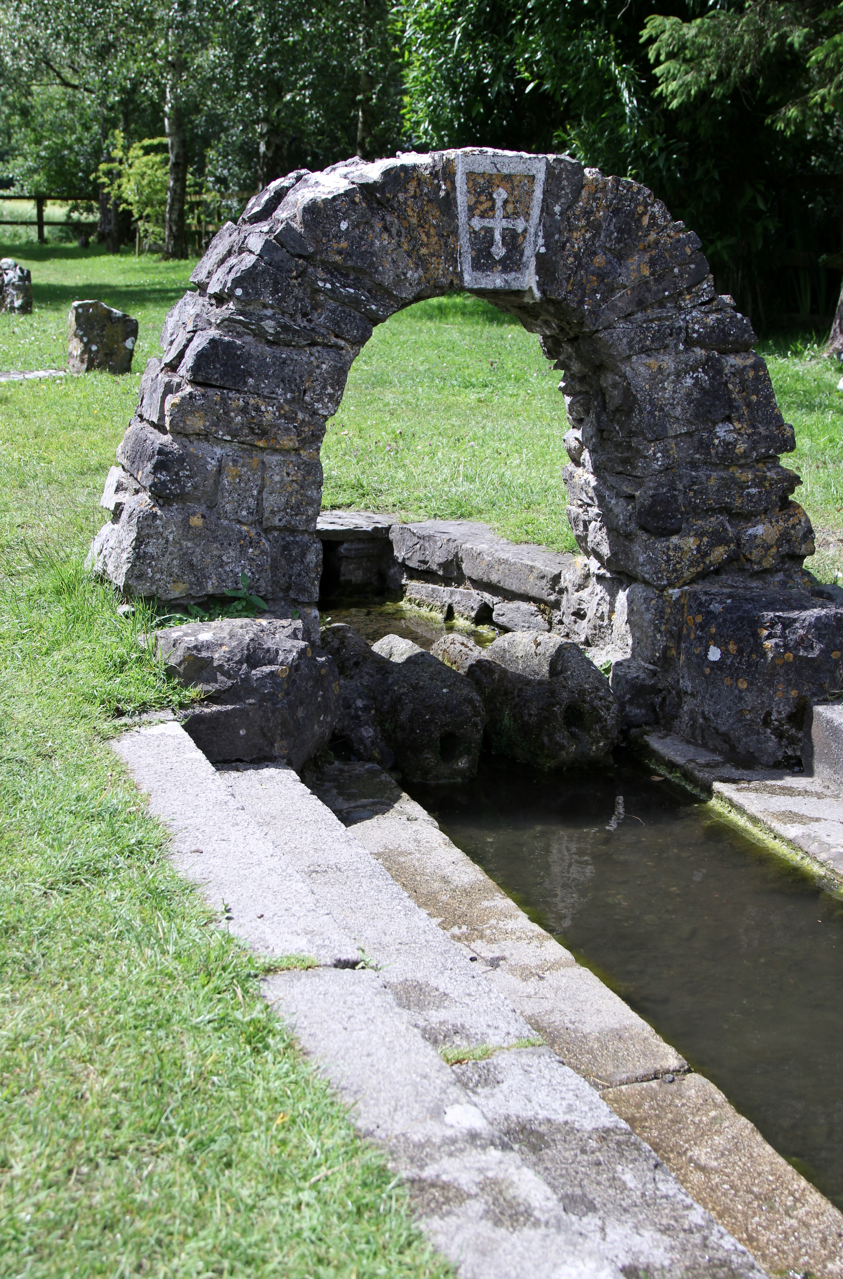
After a short break back at the heritage centre, we traipsed back over to the bus stop, pausing to take in the view of the Boyne and its clear waters - here's a view of the river downstream this time:


We got on the bus and headed to Newgrange. I'd heard from a lot of people who've visited the site before me that the place is pretty disappointing in some ways; a lot of folks aren't too happy with the reconstruction, either because they disagree with the way it's been done, and/or because the place feels a little too precise and neat. A little clinical, with all the straight edges and tidy walls, when we're used to things being a little slumped and lumpy when it comes to ancient monuments.

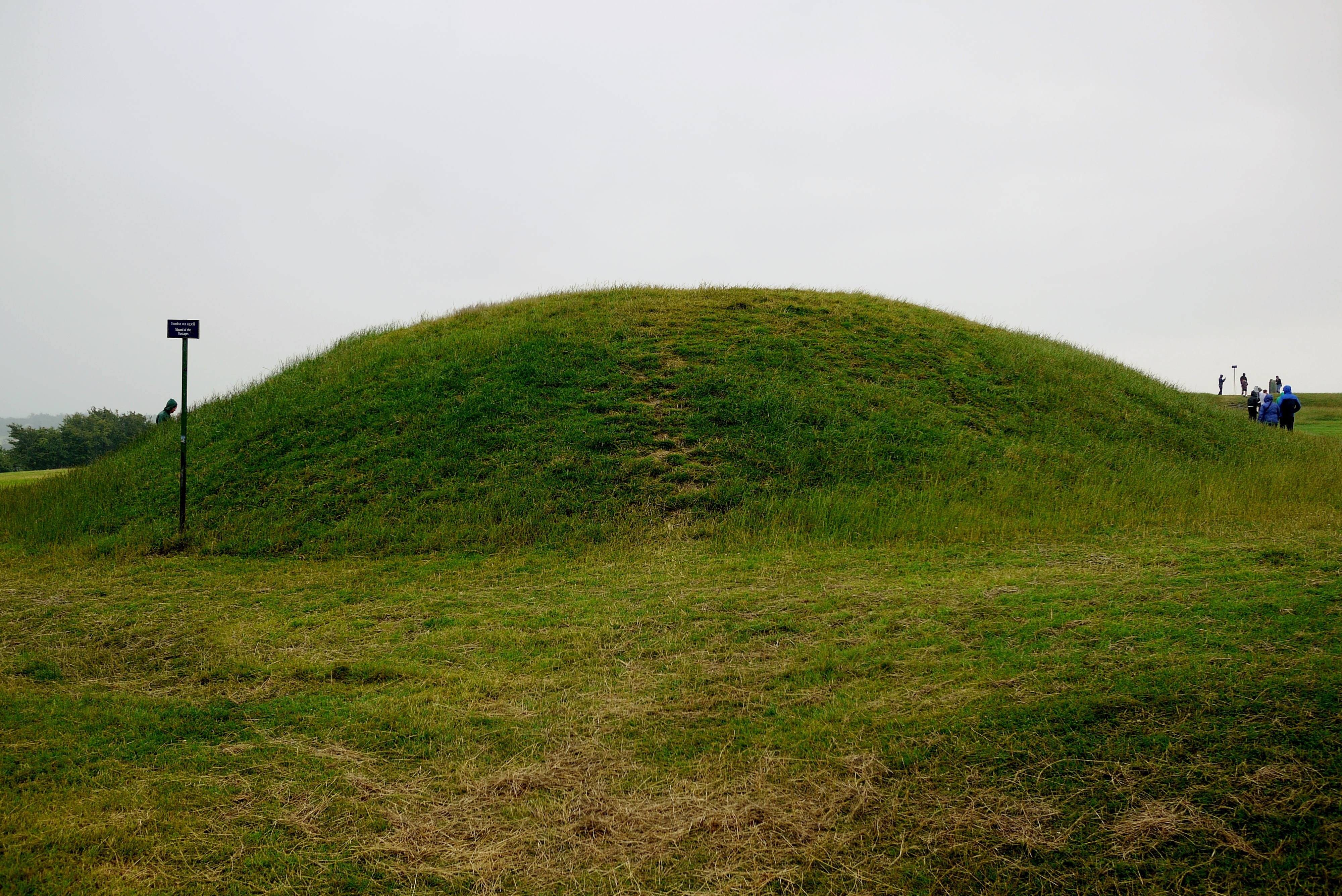
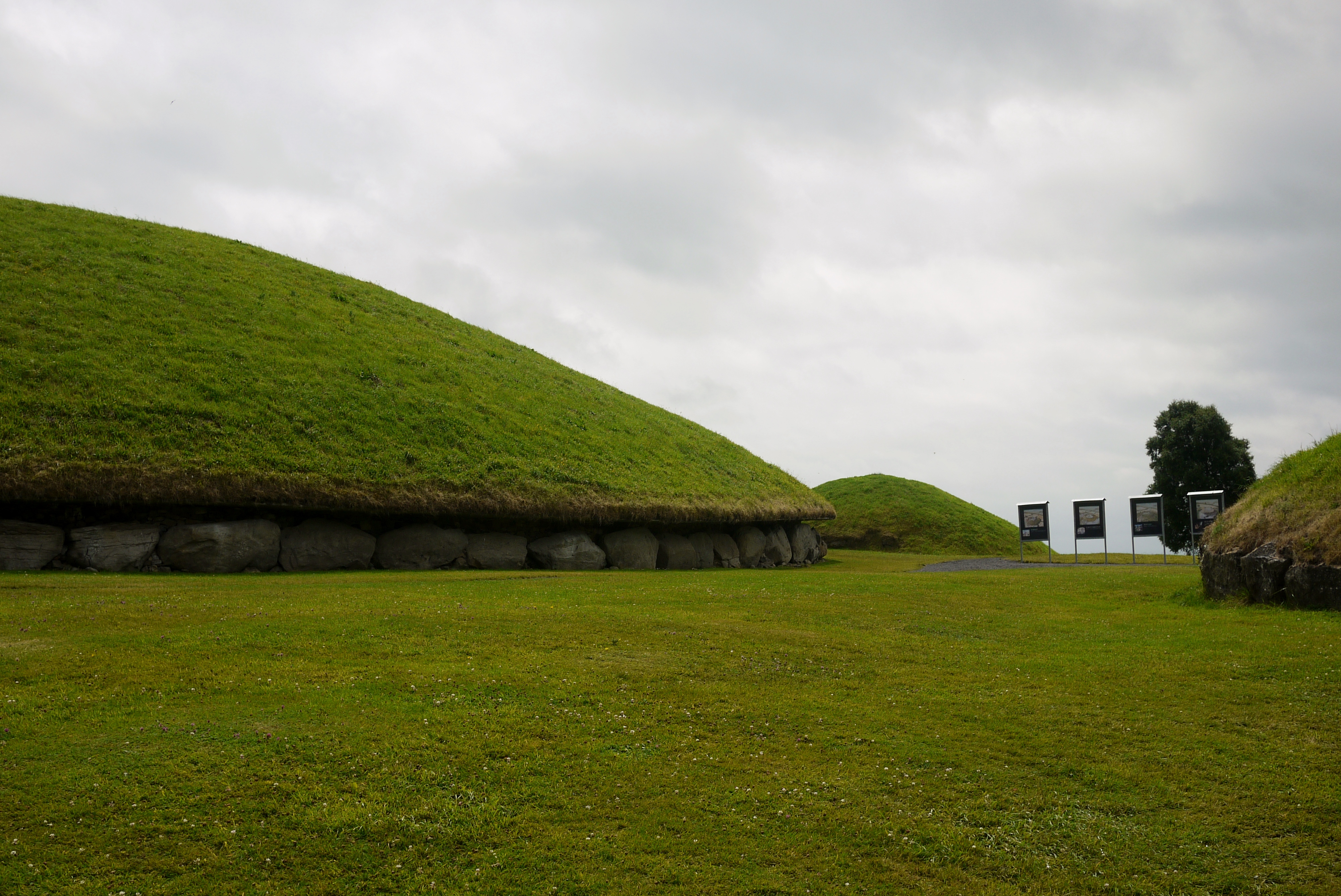
Personally, I'm not massively keen on the reconstruction, but it's not that it's "too tidy." It's that it just feels like a little bit of the spirit of the place has been trodden on, picked up, and stuffed back in, if that makes sense. The monument itself is truly impressive to look at:


Personally, I tend to err on the side of the quartz having been on the floor originally, and as my mother-in-law (also an archaeologist) commented, "Well I think we can all accept that Newgrange was a big mistake." But regardless of where you stand on the issue of the quartz walls, it's a really impressive site, whether you're far away or close up:


On a sunny day it's probably even more amazing to look at...

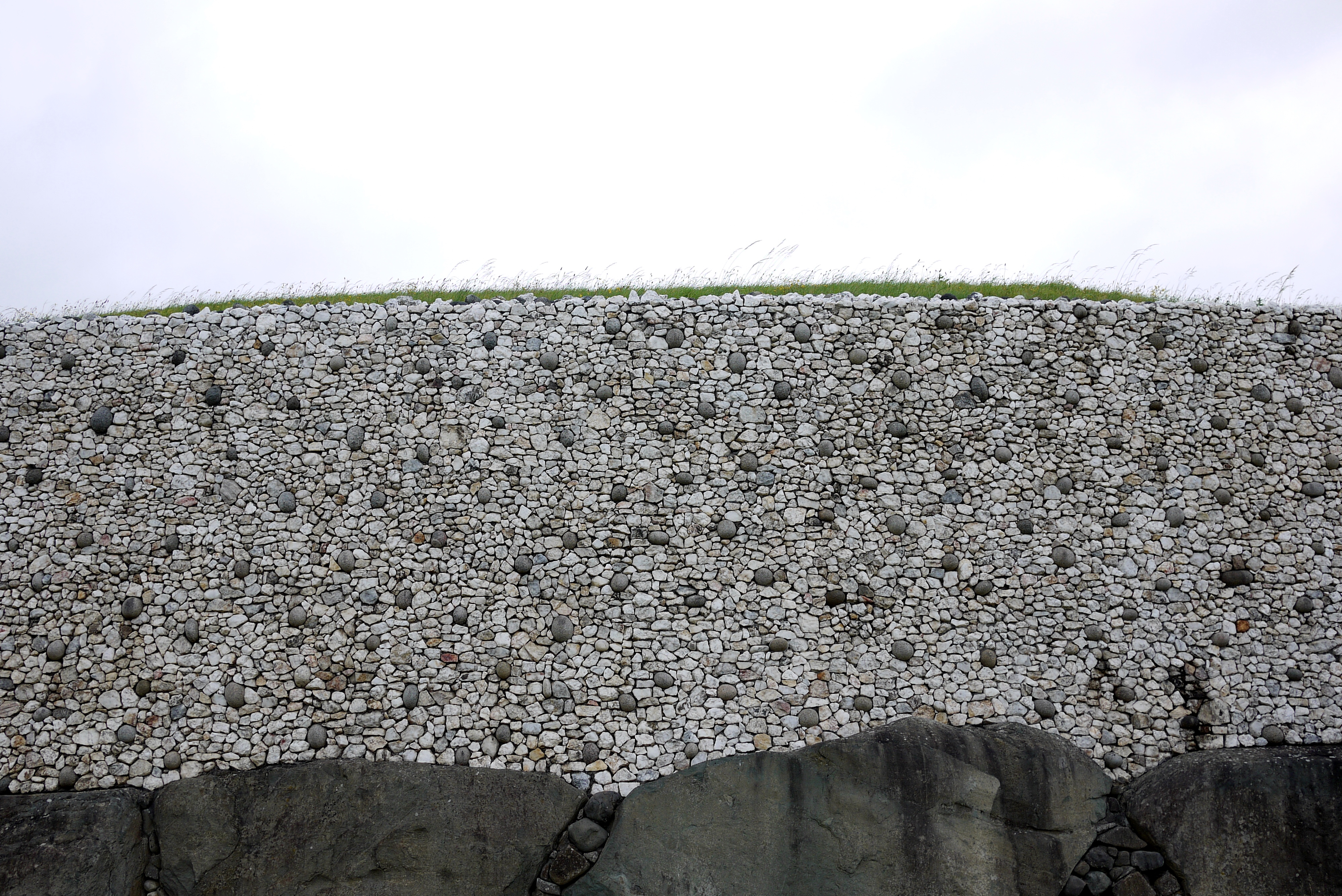
The quartz doesn't go all the way round, as you can tell from the wide shot. The back is similar to Knowth, with a protective ledge jutting out over the stones, but above the ledge there's a continuation of the wall (though not as high) in a grey stone (I'm not sure what kind):


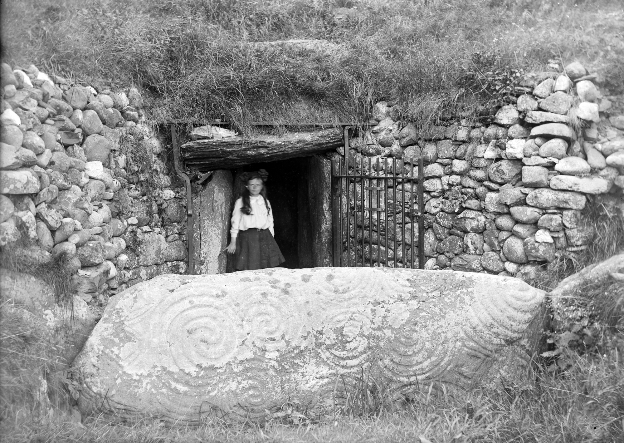
If you want to compare and contrast the old and the new look, this is a picture from the early twentieth century:


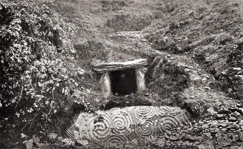
Which is itself after an attempt at tidying the place up during the nineteenth century. Before then, it looked like this:


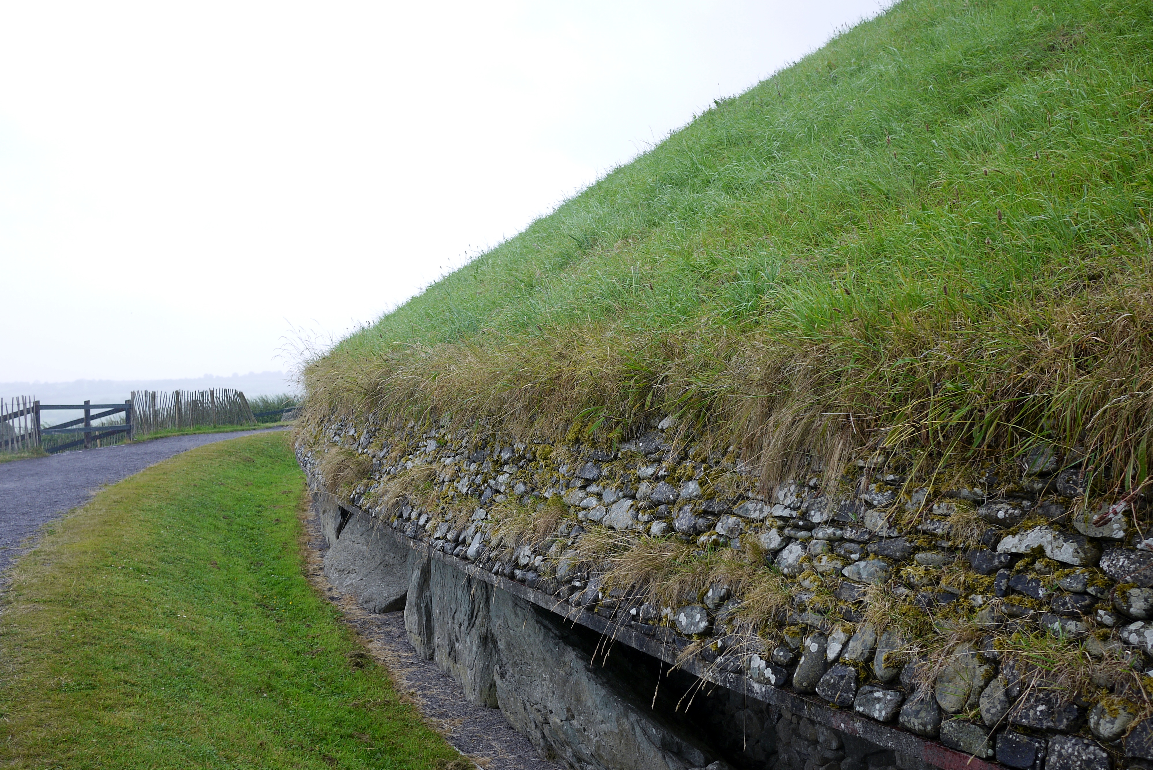
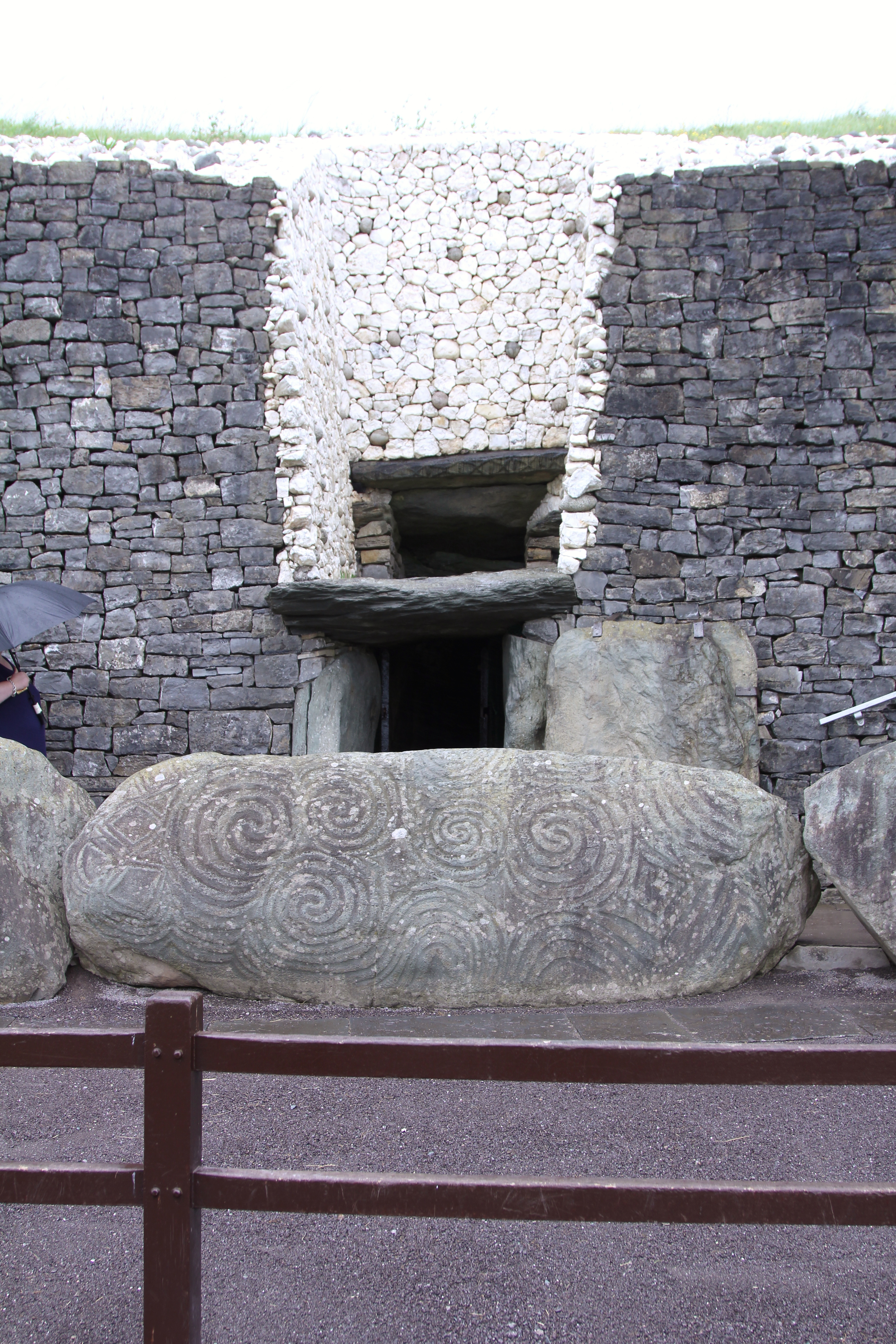
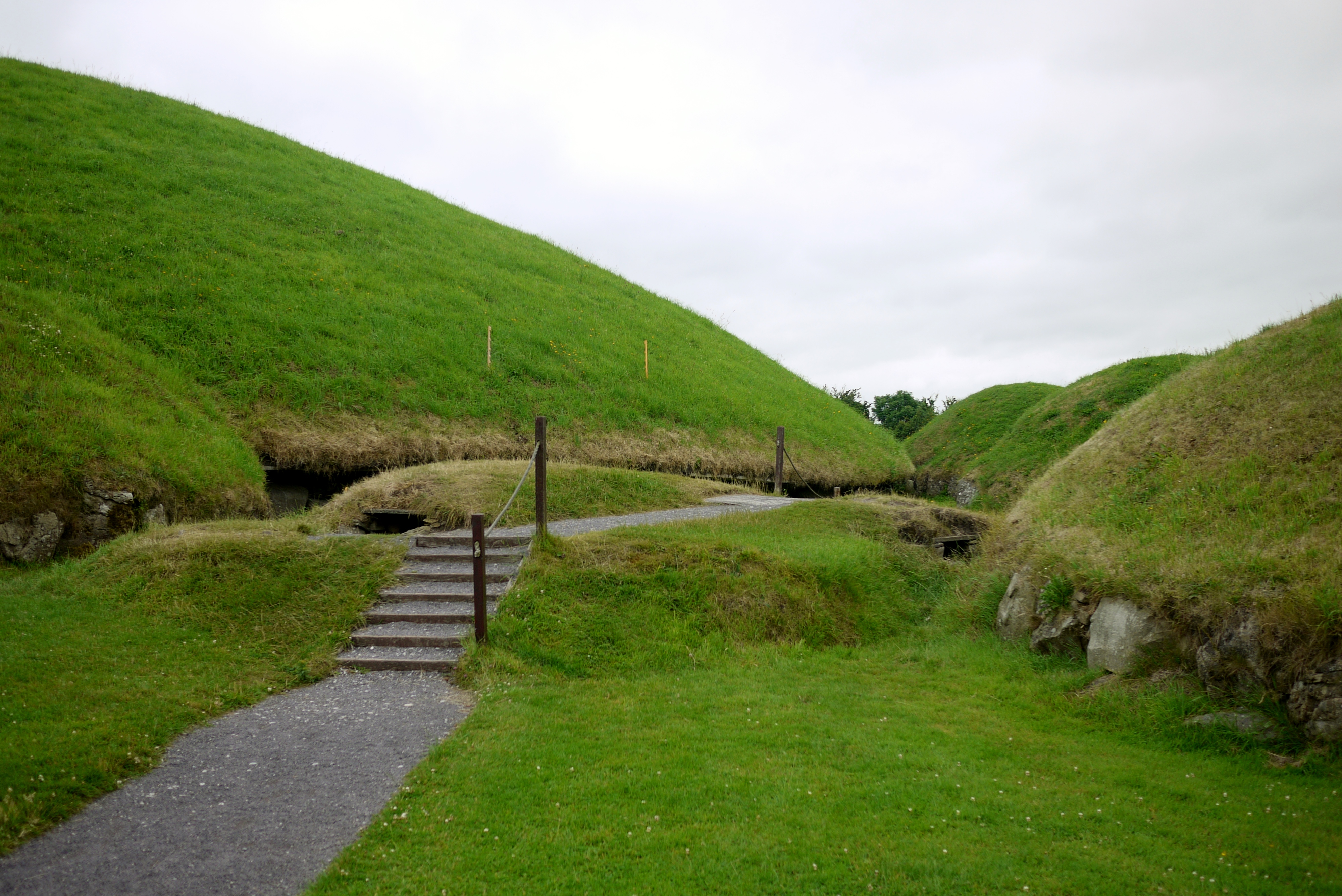
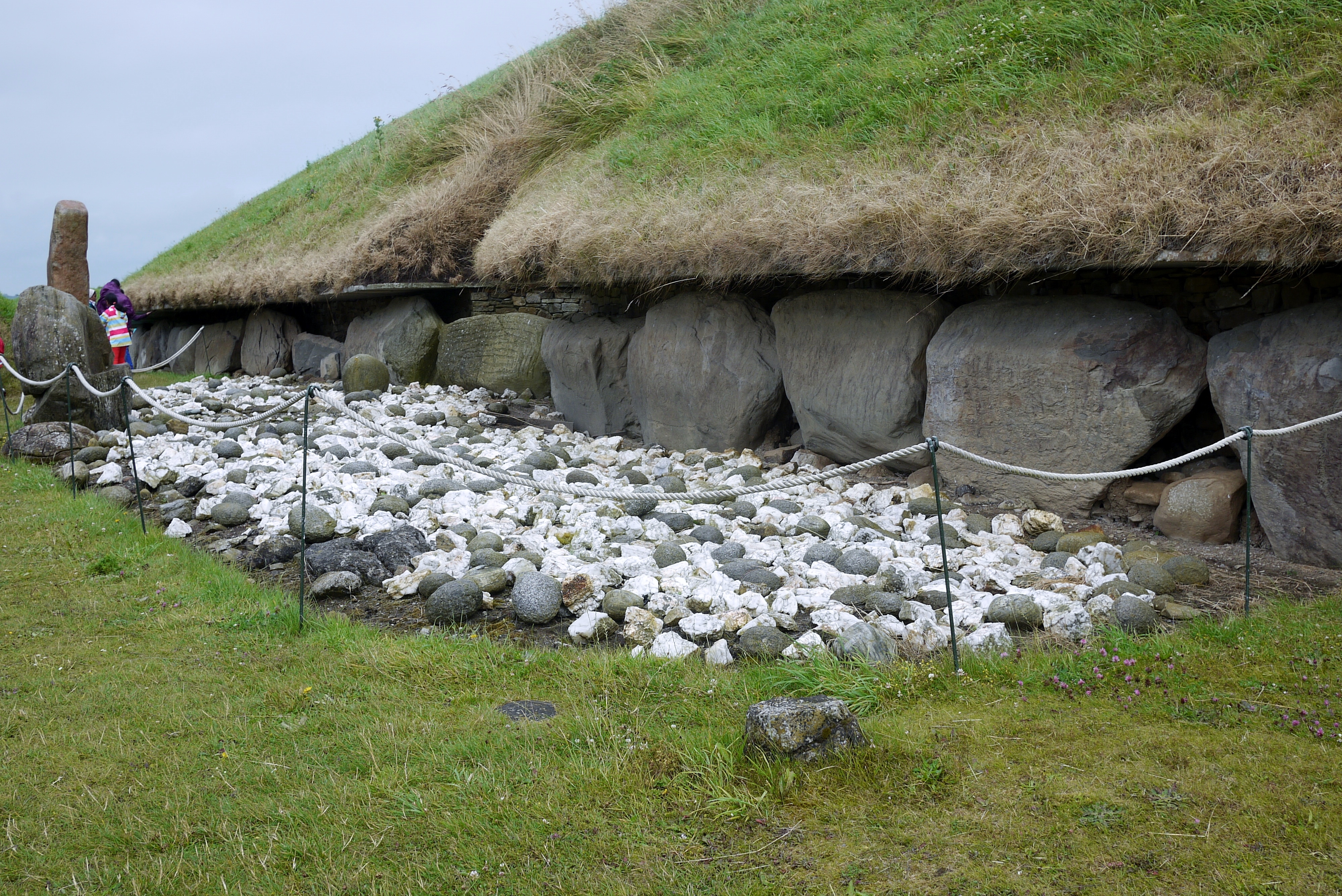
The whole mound was badly collapsed, so whatever your view of the reconstruction, it was never going to be an easy job. This is a picture of the entrance today:


From what the guide said, if I remember right, the grey limestone they've used here in the reconstruction isn't original to the monument itself. It doesn't seem to be the same stone from the early twentieth century picture, anyway.

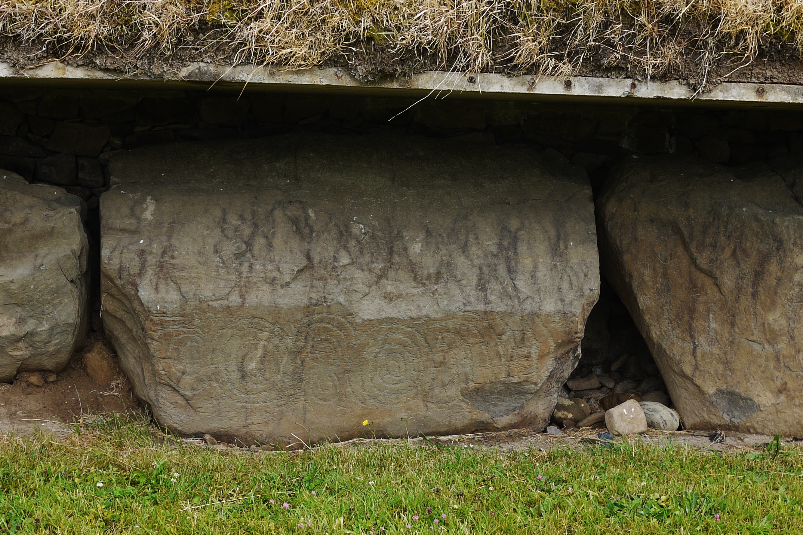
You'll notice that the famous decorated stone there completely blocks the entrance, so you can't just walk inside. You have to climb over the stone to get in, and this a feature at Knowth and other sites of this type. The theory is that it forms a physical as well as psychological barrier between the space of the living and the dead. A literal as well as symbolic delineation.

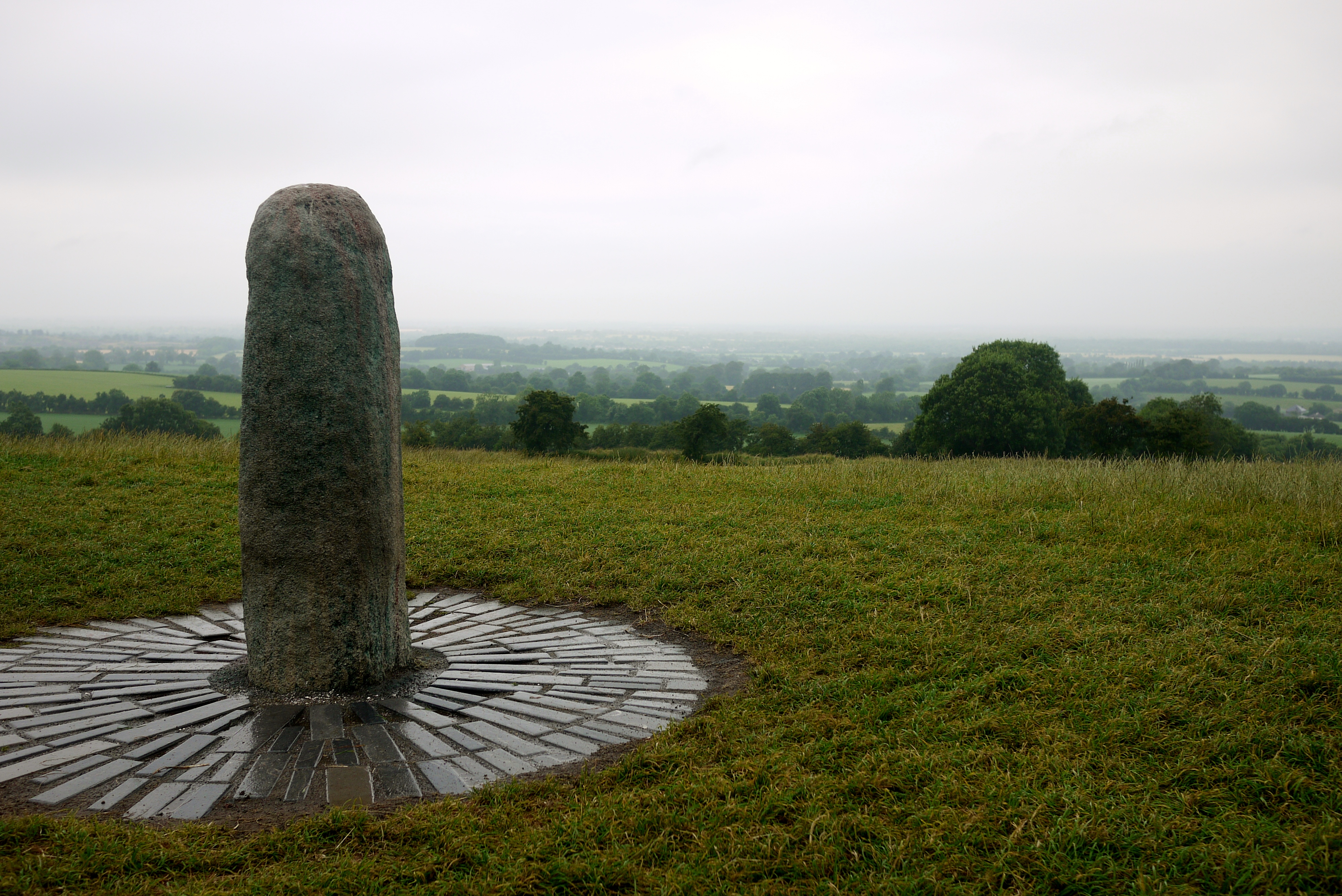
You can also see the light box above the entrance, which lets the sun right into the chamber during the period of the winter solstice at around 9am (it doesn't just happen on the solstice, it happens for a few days before and after as well, for about a week. The solstice is the peak period of time where the light shines in. Assuming there's any actual sunlight, and not just cloud...). There's a theory knocking around at the moment that suggests the light box could have been adjusted periodically, to let the sun shine in at other times as well, but I've not seen much discussion of the arguments for or against the idea to have much of an opinion on it at the moment.

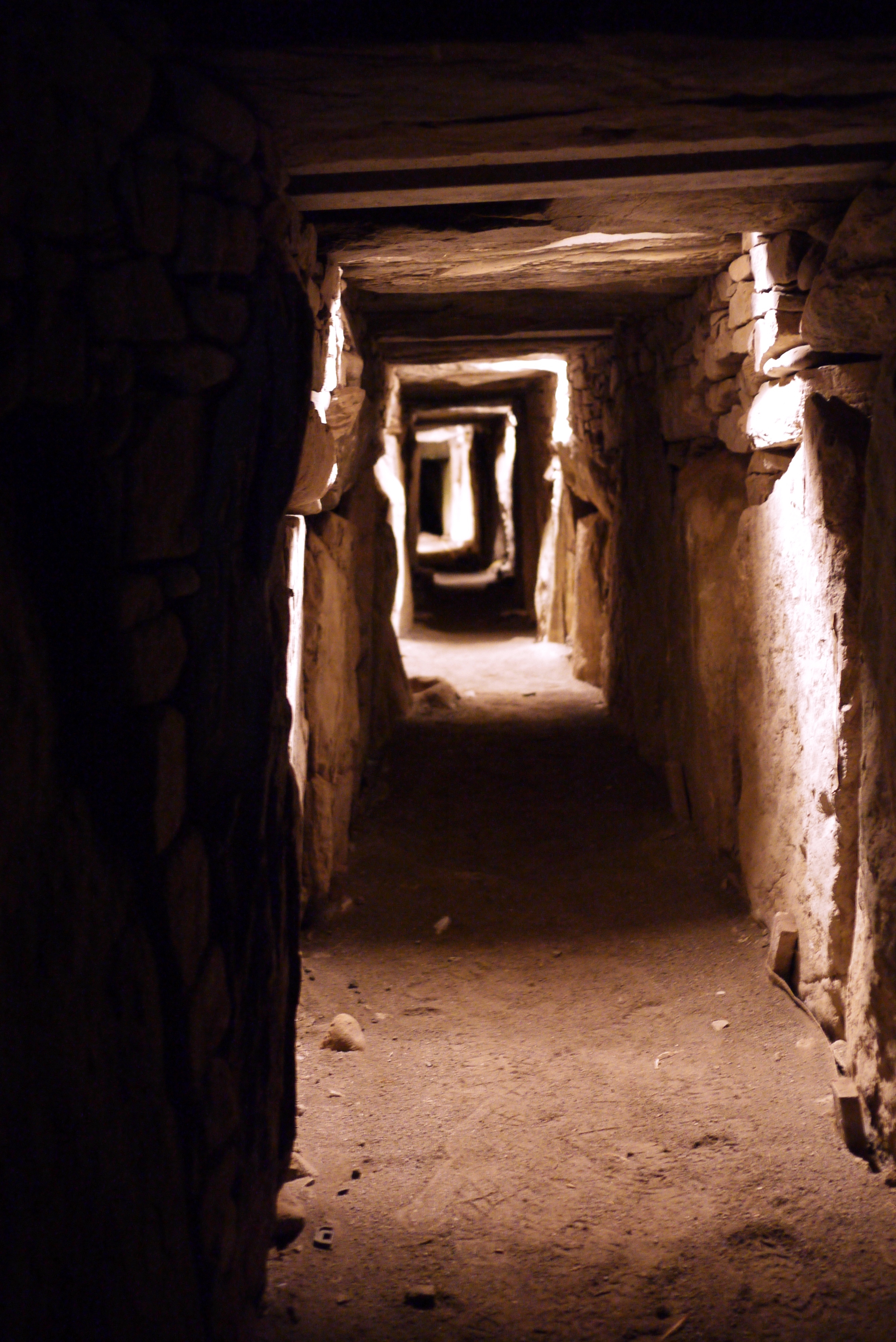
When you're bused over to Newgrange, you go in groups of up to 50 people or so. The guide takes you into the chamber inside the monument, but because there are so many people you're split into two groups so everyone can fit in. It's still a tight fit, and you're instructed not to touch the walls or wear your bag on your back in case you accidentally scrape against anything. You're not allowed to take photos inside the chamber, and the guide insisted that this was out of respect (completely ignoring the fact that the chamber has been installed with lights and electricity cables, and she regularly invites groups of 20 or so people to come and gawk inside an ancient burial place that's been thoroughly disturbed over the years). The guide at Knowth (where photos are absolutely fine) said to ignore whatever excuse the guide at Newgrange gave; the restriction on photos was purely practical and due to time constraints. Because it's so crowded when everyone's in there, it's difficult to get any good pictures and people would end up hanging around and waiting for everyone else to leave, thus resulting in a game of burial chamber chicken... Fair enough, I suppose.

But anyway. When you go inside, you start off making your way along a very low, narrow passage until you reach the chamber, which has a corbelled chamber (like a beehive), and you can stand up comfortably again. The chamber is cruciform, with a shallow recess right at the back and recesses to the right and left as well, making a cross shape. The recess on the right (as you're facing inwards) is the largest and most heavily decorated, and it contains one of those large stone basins that I included in the waffle about the displays at the heritage centre, yesterday. The basins are so large that the people who built the place must have set them in position first and build the chamber, passage, and then mound around it. Although the chamber was heavily disturbed by the time it was excavated, they found the cremated remains of four or five people, mostly on the floor but possibly originally in the basins.

The chamber is nicely lit when you first get there, but after a little introduction the guide switches off all of the lights to give an idea of what the solstice sunrise rise (using a specially placed light). At this point the guide began speculating about the meaning of the light as it works its way inside, and she began going on about the ancient mother goddess and sky god, to which I let out a quiet sigh and banged my head against Mr Seren's shoulder...

Back outside there's a little time to have a look around by yourself (we were part of the first group to go inside), and it's apparent that there isn't as much decoration on the stones as there is at Knowth - pretty much every stone is decorated there, but here only a few are. Whether that's because most of them have been robbed out and then lost or destroyed over the years, or because that's just the way it is, I'm not sure. I know some of the stones were robbed, at least.

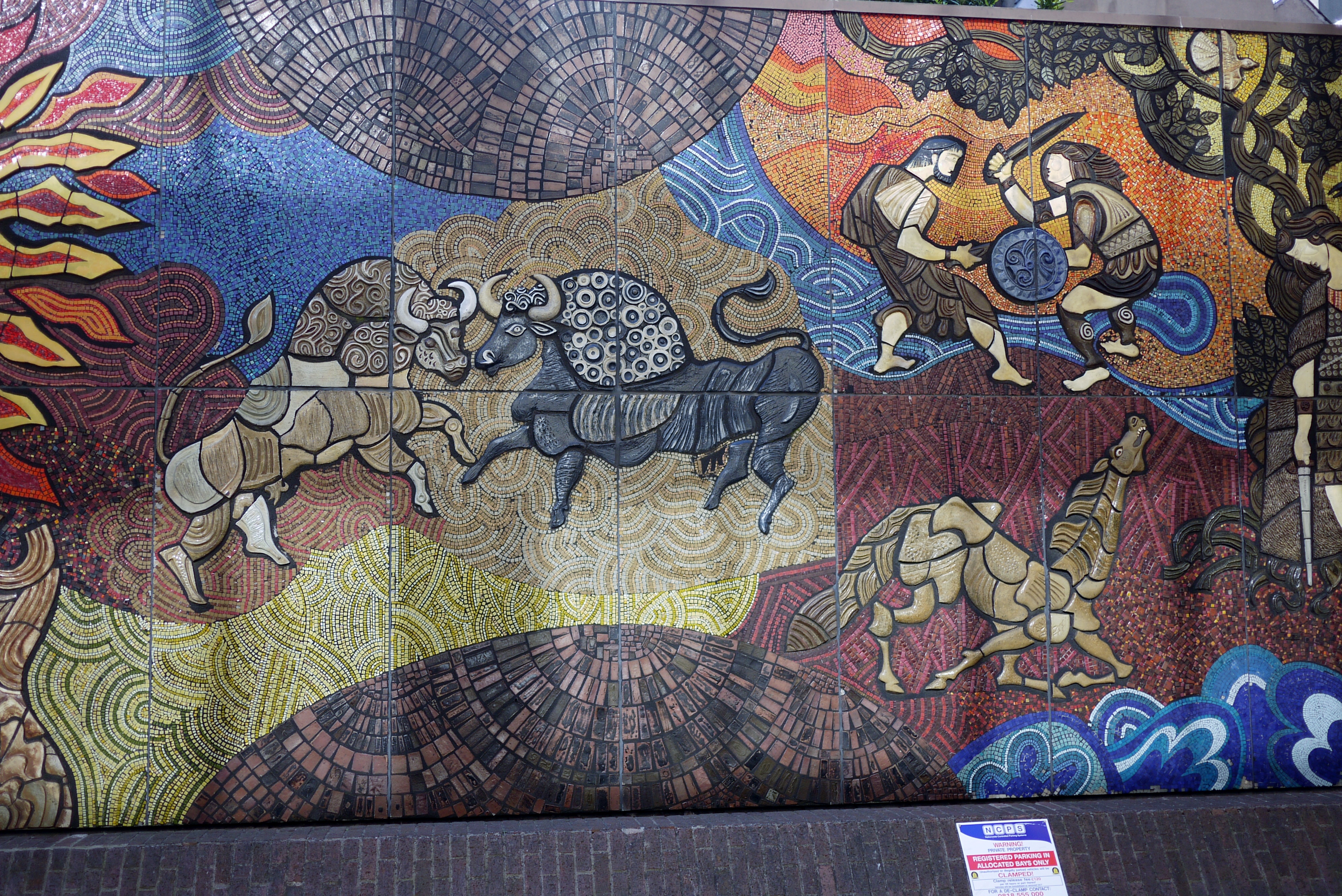
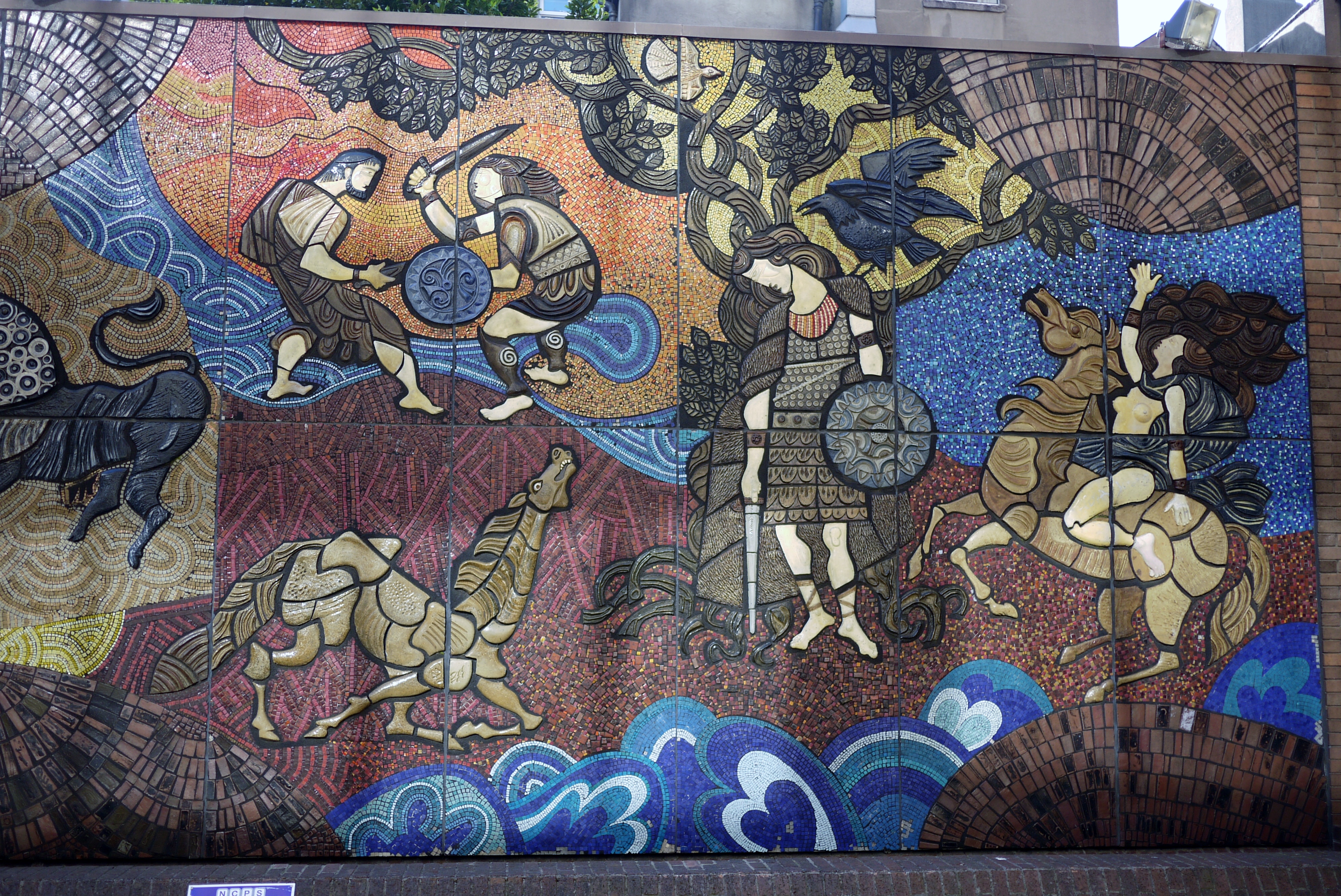
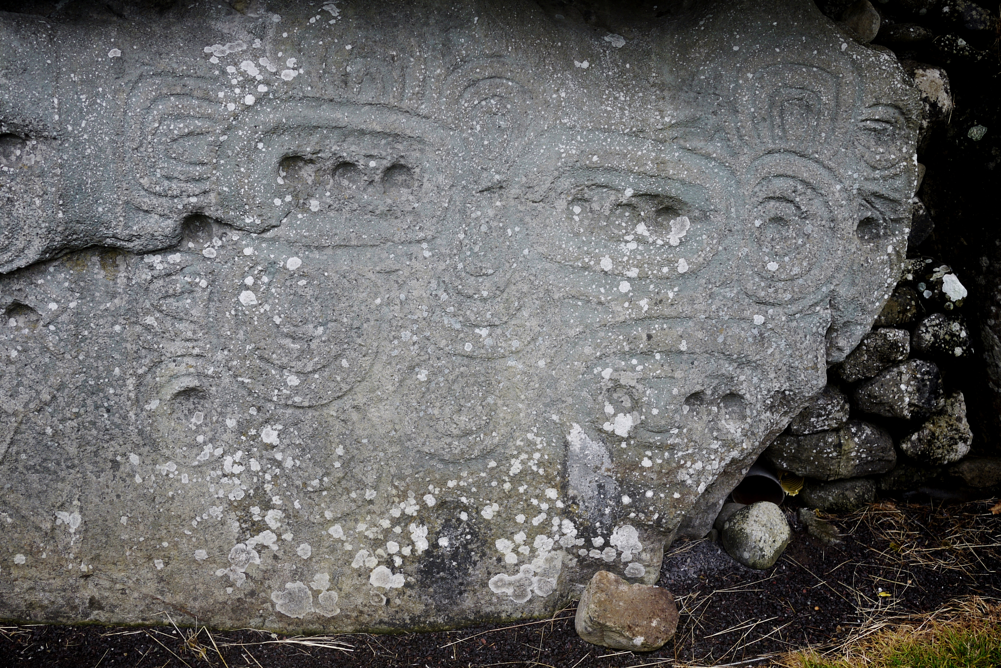
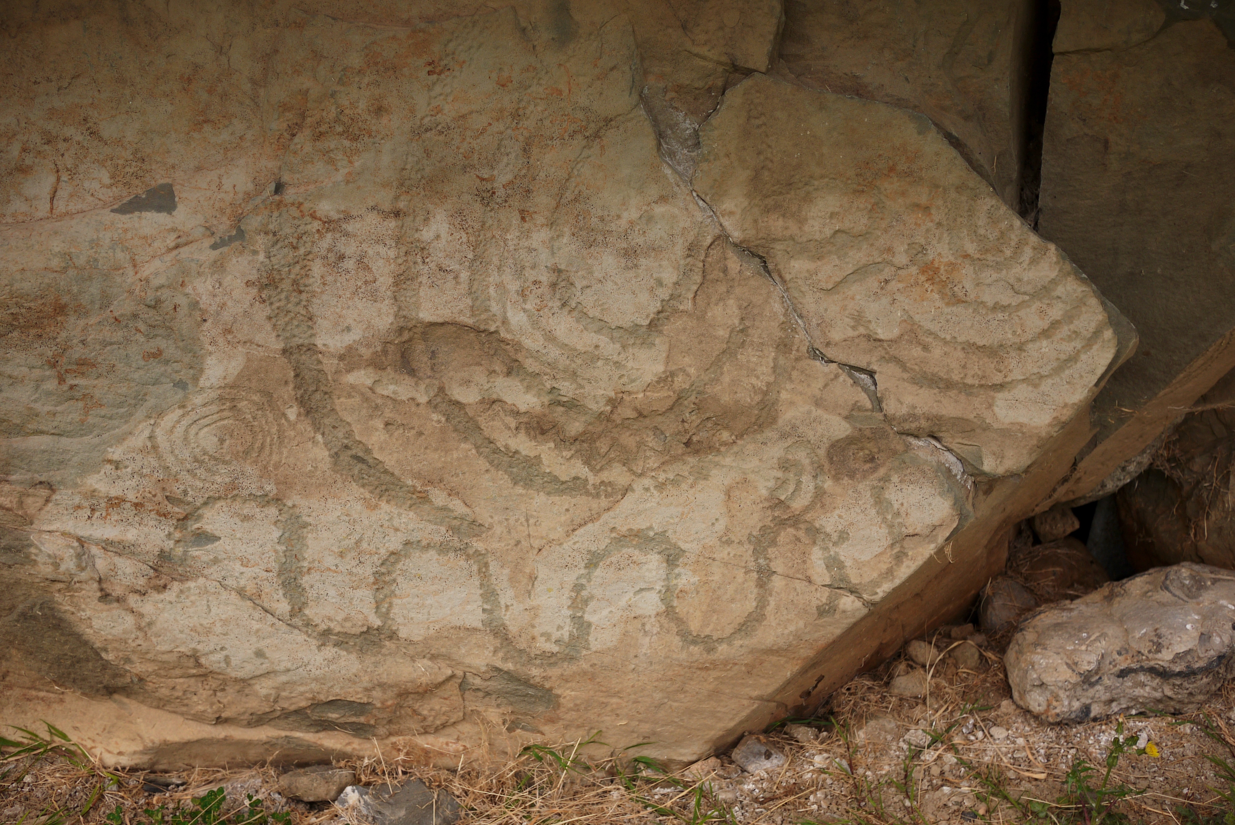
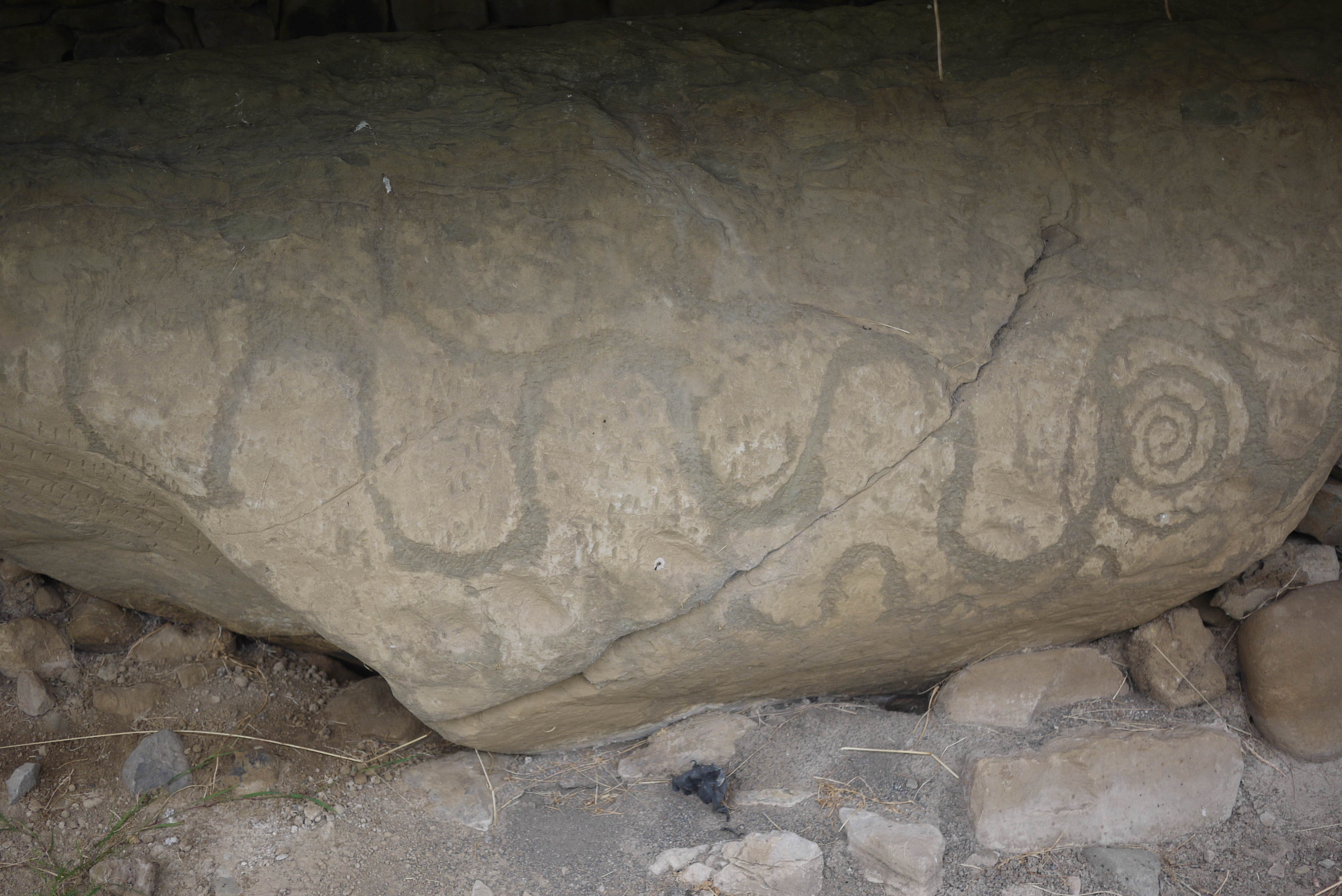
Although you see the same kind of circles and spirals as you do at Knowth, there are also a lot of geometric shapes at Newgrange, giving a very different look and feel to the art (or symbols, if you will):


These pictures are of one stone, it was so large I took two pictures just to get the details. There's also this one:


Again, what these symbols mean, we can only guess. Of course, the most spectacular stone is the one at the front of the tomb, and it would be remiss of me if I didn't give you a close up:


The detail is truly amazing on this one, and I could happily trace those spirals all day long...

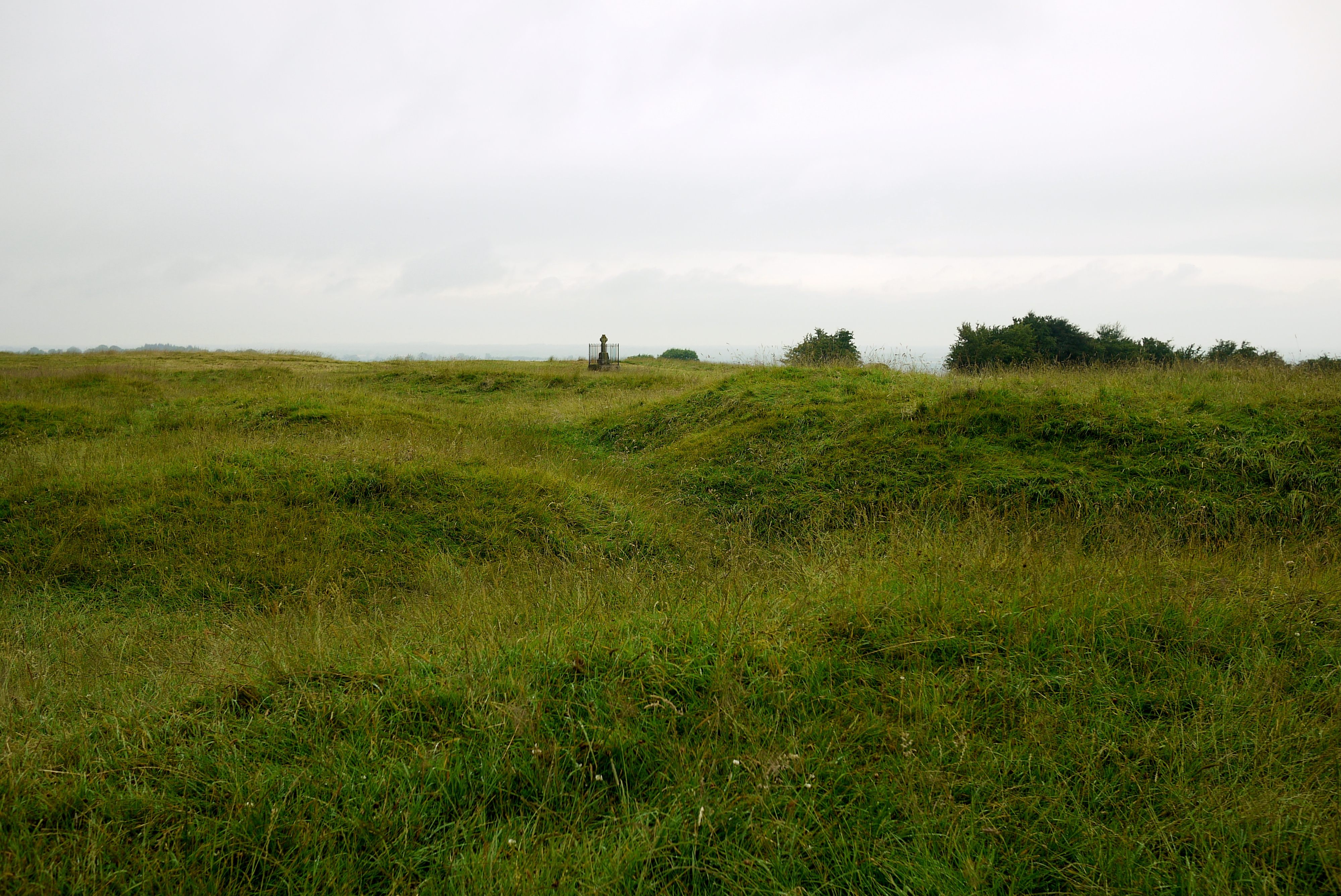
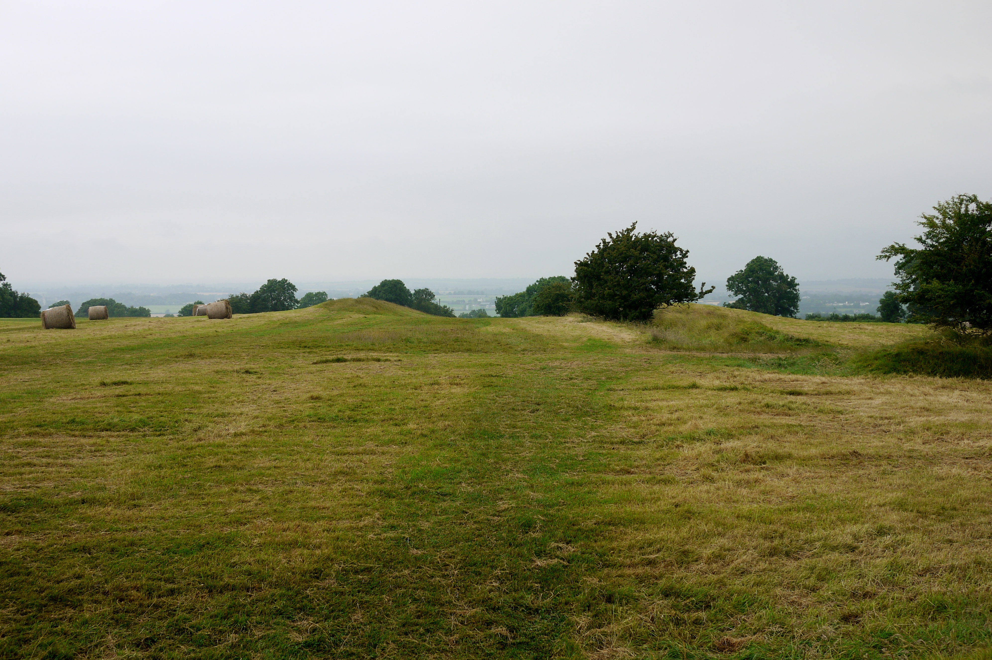
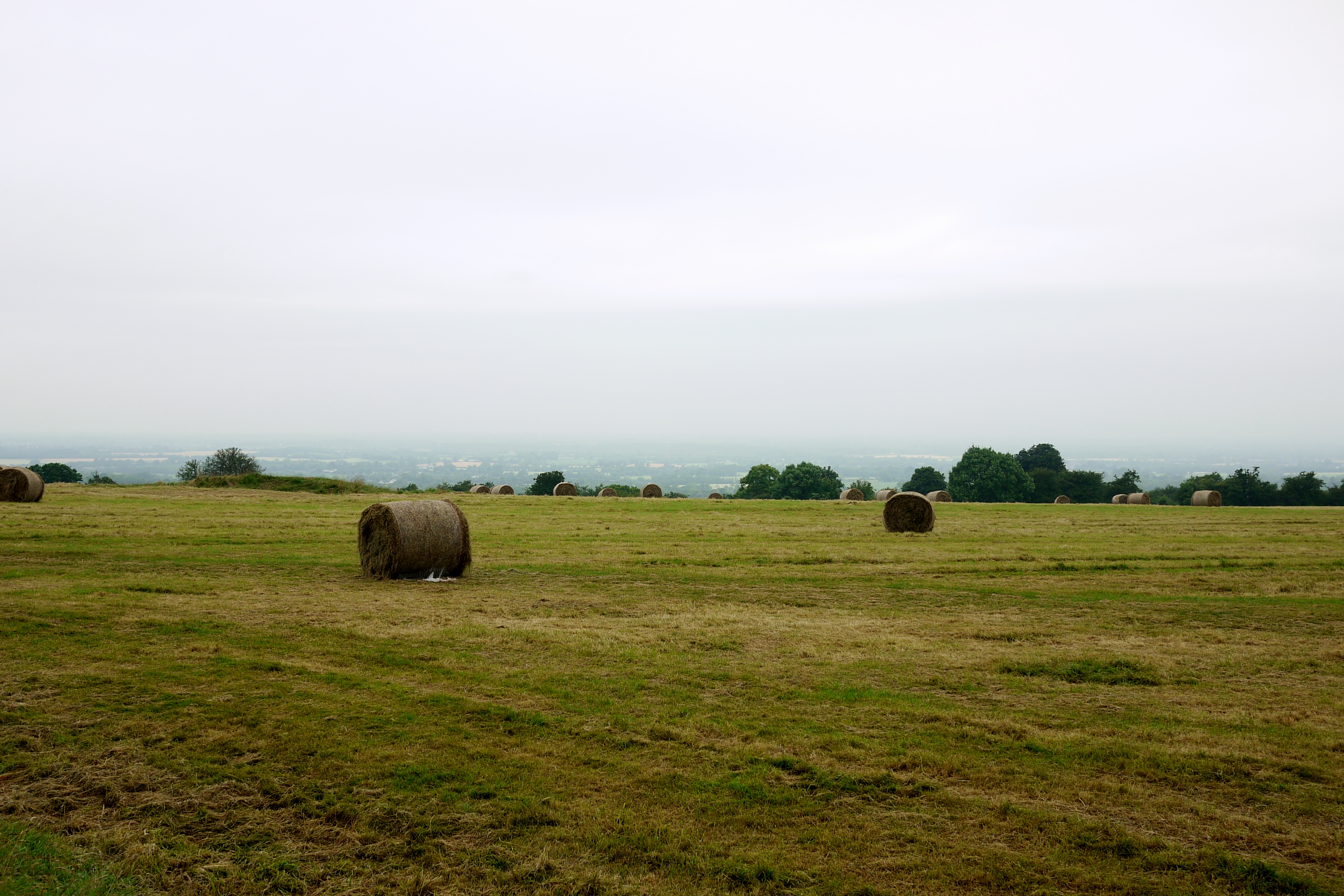
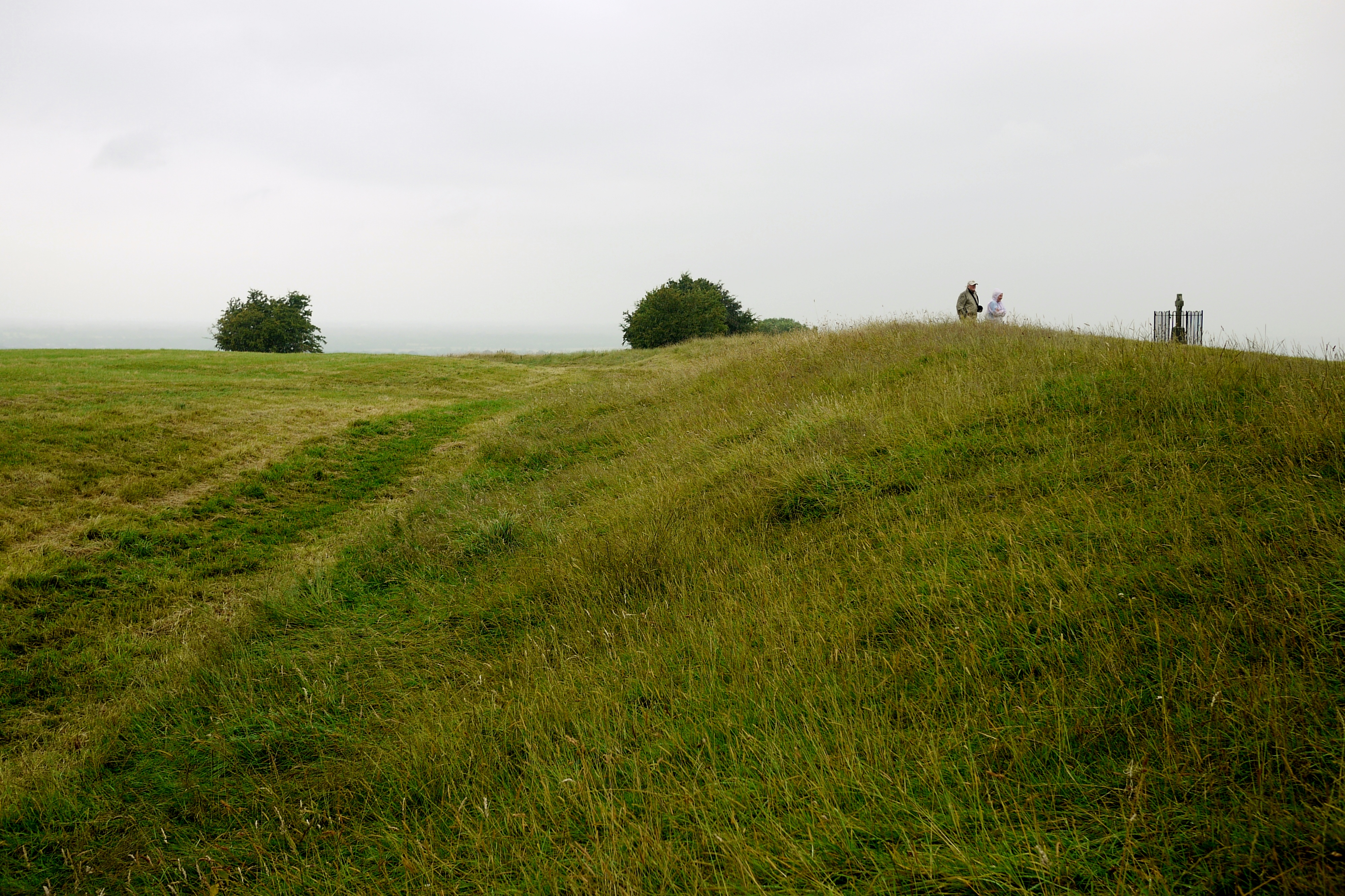
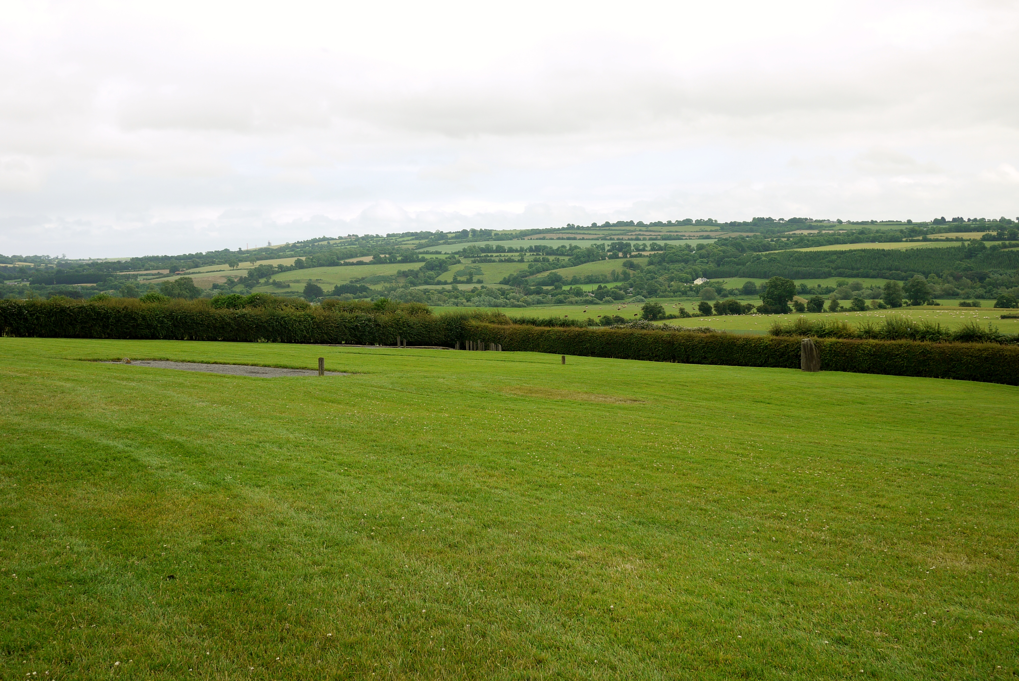
Before I finish up, let's take a look at the surroundings. Like Knowth, Newgrange is situated in a spot that commands a fantastic view of the area around it:


Though not quite as expansive as the view at Knowth:


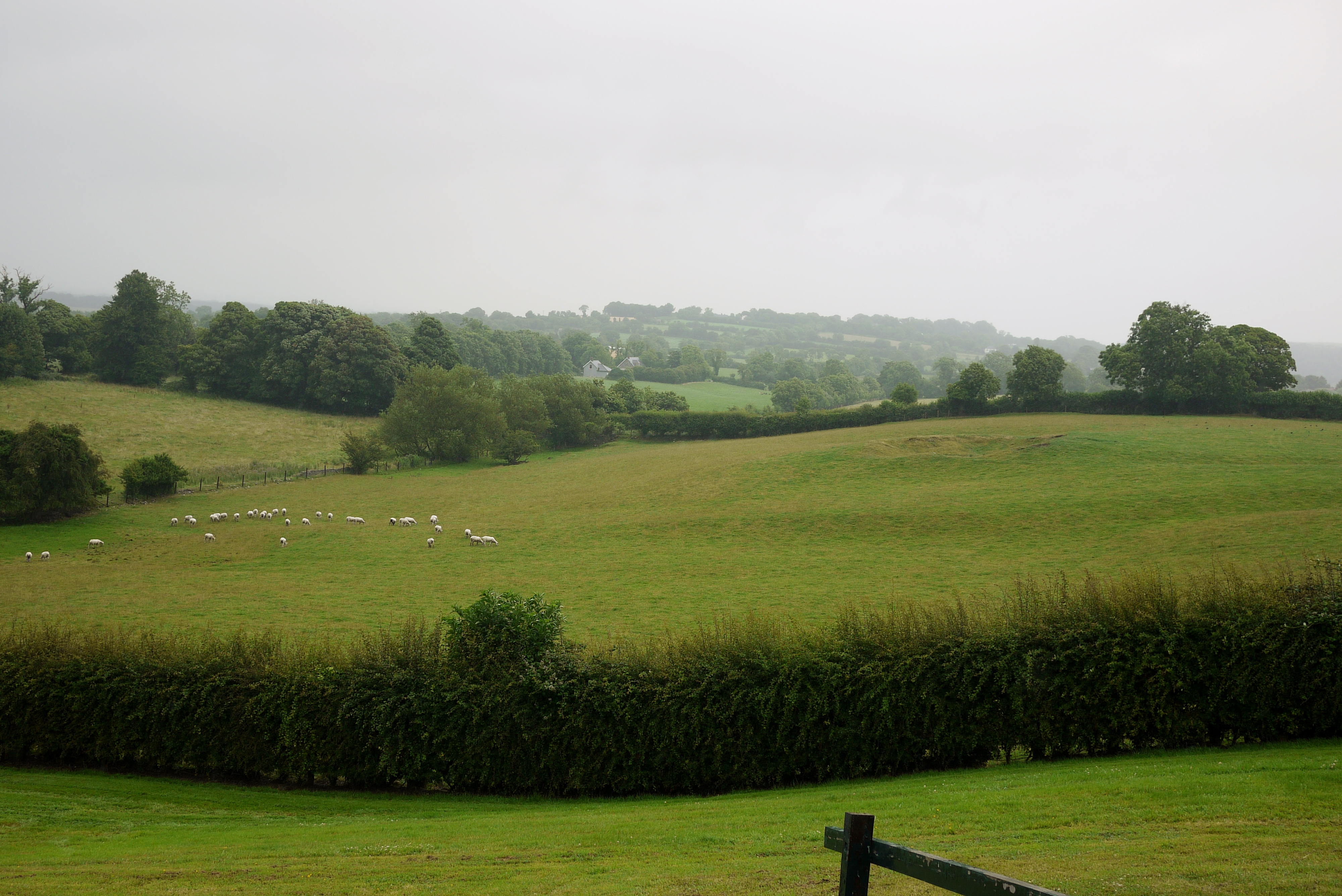
You can see a lumpy bit in the field there, and that offers a reminder of the fact that the passage tomb at Newgrange isn't isolated. There's a huge amount of Stuff (it's an official archaeological term, honest...*ahem*) surrounding it, it's just not as obvious, or accessible, today as the Knowth complex is. That's a big shame, and it's not something that the guide spoke about either. But we can't really consider Knowth or Newgrange in isolation, in and of themselves. They're part of a bigger ancestral landscape, as the heritage centre went some way in showing, and although they're very much a part of the time they were built and then used as passage tombs, they're also both very much a part of the Iron Age and beyond, up until today. Even after they fell out of use they remained significant and were tended to and revisited again and again (although at some point Newgrange was "forgotten" and then accidentally rediscovered in the seventeenth century). Knowth became a settlement, and people continued to inter their loved ones into the mound of Newgrange - or Brú na Boinne, to give it its proper title - and made offerings there. 

The two sites are pretty close together and have their own legends and myths attached - Knowth is said to be the resting place of Buí, while Newgrange is the home of the Dagda or Oengus. There's also another passage tomb nearby, Dowth, which isn't included in the tours on offer (unfortunately), and which we didn't manage to visit - though you can if you can find it. Signposting is often rather haphazard in Ireland (as is the driving)... But we have to consider the bigger picture: Their position and relation to each other, as well as their relation to other nearby sites like the Hill of Tara and the places we don't know any more, or don't know as much about. It's all a part of a landscape we only have glimpses of, really. We're missing so many of the pieces today, which is frustrating, but we also know more today than we used to. But we'll never truly know what these sites meant to the people who built them. It's unlikely that we'll ever be able to read the symbols as they were meant to be read, or understand the kinds of rituals that were held at these places. We can speculate, and we can generalise and imagine. 

But most of all we can look at these sites and know what they mean to us today. Whether they're a home of our gods or ancestors, a testament of human achievement, a symbol of a nation's heritage... They're something that will always fascinate and inspire us, however we think of them, and whatever they mean to us on a personal level. 

Sunday 20 July 2014

Knowth

To get to the buses that take you to the passage tombs, you have to leave the heritage centre and go along a path that takes you over the Boyne and some boggy bits to the bus stop. This is pretty different to how things used to be (before Newgrange was designated a UNESCO World Heritage Site), but it keeps the tourists from traipsing all over the farmland and so forth. I was at least hoping to get down to the Boyne (named after Boann, of course), but it was not to be, so I stuck to making my offerings at the monuments. The view of the river is stunning, though, especially when the sun comes out:


The weather was pretty moody when we got to the centre, and we got rained on a lot at Knowth, to start with, but the sun came out eventually. Like Newgrange, Knowth has been reconstructed, though of the two I think they've done a better job of Knowth; it retains the ancient feel a little better, I think.

Unlike Newgrange, Knowth is a complex of passage tombs that are situated close to one another. There's a large mound, pretty much in the middle of it all, and this one has the decorated megaliths around it. Then there are seventeen smaller mounds situated seemingly randomly about the place, some close to the largest mound, while others are slightly further away. There's also a soutterain from the Christian period, and a small reconstructed "wood circle" near the main mound (that wasn't explained by the guide, unfortunately).

So the main mound has been reconstructed, as I said, and today it looks like this:


Each of these stones is decorated with carvings - all kinds of circles, spirals, squiggles, and lines. Some of them are in better condition than others (bear in mind they're about five thousand years old), and in the winter the site's closed and the stones are wrapped up to protect them from the elements. There wasn't originally that shelf that overhangs the large stones at the base, that was put in during the reconstruction to offer some additional protection, so you just have to imagine that the earthen part of the mound slopes down to meet the stones like it does on other tombs of this type.

The main mound is a lot bigger than the others, and eventually a settlement was built on top of it, which lasted from around the Bronze Age into the early Christian period. There's also a souterrain from the early Christian period, which you can usually go inside (but we were advised not to because of the heavy rain that had been pouring down on and off all day). It's the wee lump just by the stairs there, nestling in beside the largest mound and a series of smaller ones to the right:


Up on the top of the main mound there's the remains of a ditch that was dug into it, but that's about all you can see. The view would've been spectacular on a clear sunny day, and it would've been a good defensive site. There wouldn't be much that you couldn't see coming...

You can go into a small chamber inside the main tomb, but these days you can't go any further, to where the actual chambers are. The passage that goes deep into the mound is artfully lit, though, so I took a quick picture:


There's another passage as well, but that came out fuzzy...

The most spectacular part of Knowth, for me, is the megalithic art that surrounds the main tomb. Some of the smaller tombs have stones around the base as well, but these aren't decorated, for the most part. Nobody can really say what these symbols mean, but I'd say there's a good chance that some of them represent the surrounding landscape. This one:


Gives the impression of the some of the mounds or sites - perhaps Knowth, Newgrange, and Dowth (which are all pretty close together)? With the squiggly line at the bottom being the river?

Here's another one with the same kind of symbols:


A lot of them are just circles, though. Some are kind of like spots, others are more like concentric circles or spirals, either spaced out or squished together like this one:


You see echoes of this on the stones at Newgrange, too. Some of them give the feel that they're probably articulating some sort of astronomical information. One of the most interesting and complicated designs at Knowth might even be a calendar (I've heard it speculated, anyway):


This is a picture I took from the heritage centre, seeing as it came out better than the actual stone in situ. Knowth is thought to have an alignment to the equinoxes, with the sun illuminating the main chamber, although this is a little controversial - some archaeologists don't agree, because the alignment was only "discovered" after reconstruction, so the idea basically relies on assuming the reconstruction is accurate. I don't see why not, though - Newgrange's solstice alignment is still quibbled about in some quarters, but there's a tendency from the naysayers to assume the people who built the monuments were "primitive" or not advanced enough to figure out complex astronomical things. I think recent discoveries like the earliest known calendar in Europe, found in Scotland, along with alignments in other monuments, show this isn't the case.

Another controversy about the reconstruction is the presence of the white quartz. It's something that's often found at sites like this, and the brightness of the quartz means that we can assume it was used for a reason - to make the sites stand out. The bright white stones would practically glow on a bright sunny day, but the stones might also have something to do with beliefs about the dead (their use in these kinds of contexts persists long after the Neolithic and Bronze Age, too).

If you've ever seen a picture of Newgrange you'll know the reconstructed walls at the front are almost entirely white quartz, except for the limestone at the entrance (which is modern). Here at Knowth, though, the quartz is laid on the ground as it was found during excavation:


So effectively, if the white quartz was used to make the site stand out, the quartz at Knowth would be most marked from above, suggesting that perhaps it had something to do with celestial/astronomical purposes; people wouldn't really appreciate the full effect from the ground. At Newgrange, it would have stood out to people in particular, but not so much from above.

However... The quartz was also found on the floor at Newgrange (it was in a pretty bad state of collapse before reconstruction), but O'Kelly did some experiments to determine whether or not the quartz had always been on the floor, or had collapsed from the wall. He "back-engineered" a stone wall and collapsed it, and decided that the pattern of deposition - the way the stones fell - was consistent with how they had been found during excavation. The archaeologist at Knowth disagreed, and felt that the stones had always been on the floor. Of course, that doesn't mean it has to be either/or; each site could have used the stones differently, but it's an issue that's worth bearing in mind when considering how we see and interpret the sites today.

On the last post I included a picture of a "phallic" stone, which had two "horseshoe" shapes carved near the base. We see these shapes again at Knowth:


The stone is badly worn at the top, but you can just make out the two "horseshoes," side-by-side, on the main body of the remainder of it, with a straight line above them. Either this stone or another stone (that's basically the same layout), has another two "horseshoes" above this line, placed upside down this time, reflecting the two "horseshoes" below the line. What these shapes mean, nobody knows, but their recurrent usage is presumably significant.

One final picture, and then the blether is done for this post (promise!). Mr Seren was convinced that the carving on this stone is tantamount to a prehistoric goatse:


If you've no idea what goatse is, you probably don't want to know. Save yourself and don't Google it...

Up next: Newgrange.